
Link gekopieerd. Plak de link in Instagram om de route te delen.

Dankzij onze partner haroldslegers krijg je gratis toegang tot deze route – én maak je kennis met RouteYou PLUS.
Ontdek alle voordelen
 Azure
Last update 28-Oct-2017: the climb between the hamlets of Schaphausen and Karstraße is no longer entirely on the main road, but partly on wirtschaftswegen so that extra altimeters are made.
The landscape along the track is varied: slightly hilly, often the track goes through meadows and arable lands and past farms, a few times the track goes through forest area. In total there are 11 notable climbs on the track, where the height differences vary from 20 to 40 meters.
The track starts from the parking lot at the Herungerberg velodrome in Venlo.
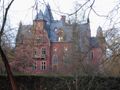
The track (counterclockwise) goes along the Groote Heide, the gliding airfield and then into Germany past Krickenbeck Castle and along the two adjacent lakes (attention: in good weather there can be many hikers on the combined footpath / cycle path). The Hinsbecker hill country (Hinsbecker Höhen) is literally left for a while.
Via the asphalted cycle path over a former railway line, the track goes towards the Süchtelner Höhen, the hill country around the town of Süchteln. Here you get three climbs (all with max. 7 to 9% ascent): Koethberg, Mühlenheuweg and the Benzenberg. Then the track goes to the Hinsbecker Höhen. You climb the Pollenberg and Schaphausen. A descent of 6% takes you to Hinsbeck and then follows the ascent of Oberstraße with a maximum of 10% ascent. Then the track goes through the valley of the river Nette and you climb to the forest area of the Wankumer Heide towards Herongen.
Around Herongen there are also some hills, the Heronger Höhen. On this track you take four climbs of the Heronger Höhen (maximum 7% ascent): Mühlenberg, Moalenberg, Riether Straße and a short climb at Straelen. Via the Dutch village of Schandelo and nature reserve Zwart Water you arrive in Venlo (district 't Ven). Just before the end of the ride you have to climb up a steep edge via the Genraydelweg (maximum 8% ascent).
Characteristic of this track are the many asphalted roads closed to car traffic (except agricultural traffic), these roads are called wirtschaftswegen in Germany. The roads on this track are often in good condition. In Viersen (after the ascent of the Benzenberg) you follow a tiled cycle path on the left side of the road, which descends steeply and below you have to turn left.
Through roads are avoided as much as possible, but are therefore crossed more often (that sometimes means paying close attention when crossing). All in all, it means that this route is less suitable for large groups.
Iets opgevallen op deze route?Probleem toevoegen
Navigeer de route met...
 RouteYou app Open

Even geduld, je afdruk wordt voorbereid.
Je afdruk is klaar om te downloaden. Veel plezier onderweg!
Het verwerken van de aanvraag is mislukt. Gelieve het opnieuw te proberen.
Bijkomende feedback:
Deze functionaliteit is exclusief beschikbaar voor RouteYou PREMIUM-abonnees.
Probeer nu 1 maand gratis en ontdek het verschil! We vragen geen betaalgegevens en het stopt automatisch na je proefperiode van een maand.
© 2006-2026 RouteYou - www.routeyou.com


 haroldslegers




 Downloaden


