Azure
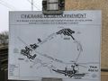
AzureStart- und Endpunkt der Route: , 7411 Tuntange. Streckenstatistik: Der Gesamtanstieg beträgt 1009 Meter. Die maximale Steigung beträgt 15,3 % und die durchschnittliche Steigung 1,64 %. Schmieren Sie die Beine.
See something wrong on this route?Add an issue
Navigate route in...
![]() RouteYou app Open
RouteYou app Open
Don't want to see this ad anymore?
→ Upgrade now
![]()
Please wait, the navigation is being prepared.
You can now navigate. Have fun on the road!
Processing your request has failed. Please try again.
Don't want to see this ad anymore?
→ Upgrade now
![]()
Please wait, your download is being prepared.
Your download is ready. Have fun on the road!
Processing your request has failed. Please try again.
Don't want to see this ad anymore?
→ Upgrade now
![]()
Please wait, your print is being prepared.
Your print is ready to download. Have fun on the road!
Processing your request has failed. Please try again.
<iframe src="https://plugin.routeyou.com/routeviewer/free/?language=en&params.route.id=4215688&params.language=de" width="100%" height="600" frameborder="0" allowfullscreen></iframe>
<p><a class="routeYou_embed" href="https://app.routeyou.com/de-lu/route/view/4215688?utm_source=embed&utm_medium=article&utm_campaign=routeshare&navigation=external" title="Arnold Kontz für Radtouristen - RouteYou" target="_blank"><img src="https://image.routeyou.com/embed/route/960x670/4215688-de@2x.png" style="width: 100%; height: auto;" alt="Arnold Kontz für Radtouristen"></a></p>
Additional feedback:
This feature is only available to RouteYou PREMIUM subscribers.
Try 1 month for free and discover the difference! We don't take any payment details, and your trial ends automatically after one month.
© 2006-2026 RouteYou - www.routeyou.com