3727 vues | Public | allemand • français • néerlandais
Start and Arrival: Parking lot at the end of Munkenhofdreef, Wielsbeke.
Length: 7.5 km
Accessibility: Difficult to access with wheelchair and stroller.
A long time ago, the Leie was straightened to serve as a canal for freight traffic. The beautiful walk allows us to learn about the still existing old Leie arms and the corresponding meadows, an "old" forest, and some valuable historical buildings.
1. You start at the parking lot and head towards the old Leie arm. This Leie arm was cut off during the last straightening of the Leie in the late 1970s. You take the outer side of this Leie arm and walk between two historical sites. On the left side is the Munkenhof, and on the right side the castle of Ooigem. In the 9th century, a fortified motte was built, which was the main settlement of the region. Over the years, the site was transformed into the castle that stands there today. Through the trees, the classified pigeon house and the disgrace violin can be seen.
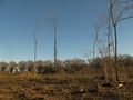
2. Shortly after the castle of Ooigem, you turn right and walk to the main road. Cross this road and go towards the Leie. Just before the bridge, you turn right and take the dike path. You briefly follow the dike path and then at the birth forest, turn right into the meadows towards the Ooigembos. Pay attention to the beautiful old hawthorn hedge with its rich birdlife. The Ooigembos is an "old" forest and the only historical forest area of this size and quality in the West Flanders Leie valley. The rich spring flora consists of wood anemones, wild hyacinths, Solomon's seals, and slender primroses, and with a bit of luck, you may also find the rare single berry here. Buzzards and sparrows breed in the forest, and during summer the kestrel can also be admired. Besides the birds of prey, many forest birds are also seen, such as the nuthatch. Recently, in the part of the Ooigembos that borders the Leie, the poplars were cut down. The large cultivated poplars hindered the natural regeneration of elm and hornbeam in this part of the forest. With the cutting down of these poplars, the diversity of fauna and flora in this part of the forest will be significantly higher in a few years than before.
3. In the forest, you turn right at the T-junction and shortly later turn left before the houses. You follow this path until you reach the intersection with Leembosstraat, where you turn left. A recently planted area between Ooigembos and the old Leie arm of Bavikhove beautifully shows the difference between the "old" forest with its lovely undergrowth from before and a new forest that is developing.
4. You walk until just before the Leie and take the inner side of the meander on the right.
Along the water, various species of sedges can be seen, and in summer, the blooming riverside plants provide a magnificent spectacle. In the wet meadows, you can find cowslips and bladderwort. Occasionally, the kingfisher flits over the water, and in the reed belts, the waidagu has been regularly spotted in recent years. Also, pay attention to the old flax factory with clearing pits, squinting, and the brick kiln chimney, a remnant of the once flourishing flax industry along the Leie.
The paths between the old Leie and the Leie lead you into an area where blackthorn and hawthorn color the hiking trail in spring. The windless spots along this part of the path are popular with many butterfly species such as the aurora butterfly, the map butterfly, the lemon butterfly, and the increasingly rare hay butterfly. Along the shores, it is again dragonflies and females that steal the show.
5. At the end of the old Leie arm, you return along the dike path at the height of Plaatsebeek. Cross the Plaatsebeek over the dike path along the Leie and continue your way along the outer side of the meander. In the Plaatsebeek valley, valuable wet valley meadows lie. The steep edges, wet meadows, pollard willows, and spring zones with reed and bitter field crow make the area a jewel. Be sure to take a moment to read the poem "Sonnenwende" by our local river poet Yves De Bosscher.
6. You return to the dike path and continue your way towards the starting point. Along the dike path, it is best to walk at the top of the hill so that you can keep a good eye on the banks of the Leie. At the waterline, shorebirds and large yellow wagon tails are regular guests. Also, take a look at the pushed-back banks, where the concrete reinforcement has partially sunken due to the waves of ships. You might discover a nest of a kingfisher or a bank swallow. Just before you arrive back at the parking lot, you will see an old fortified farm. This is the Munkenhof, a historically very valuable farm. Remains of a Frankish farm have been found, but it is mainly the monks of the Gent Sint-Pieters Abbey who have left their mark in the region since the 10th century.
This walk previously appeared in Klimop 2017-1.
Klimop is the members' magazine of Natuur.koepel vzw. More info: http://www.natuurkoepel.be
Vous avez remarqué quelque chose sur cet itinéraire ?Ajouter rapport
Parcourir l'itinéraire dans...
![]() Application RouteYou Ouvrez
Application RouteYou Ouvrez
Vous ne voulez plus voir cette publicité ?
→ Actualiser maintenant
![]()
Veuillez patienter, la navigation est en cours de préparation.
Vous pouvez maintenant naviguer. Bonne route !
Le traitement de la demande a échoué. Veuillez réessayer.
Vous ne voulez plus voir cette publicité ?
→ Actualiser maintenant
![]()
Veuillez patienter, votre téléchargement est en cours de préparation.
Votre téléchargement est prêt. Bonne route !
Le traitement de la demande a échoué. Veuillez réessayer.
Vous ne voulez plus voir cette publicité ?
→ Actualiser maintenant
![]()
Veuillez patienter, votre impression est en cours de préparation.
Votre impression est prête à être téléchargée. Bonne route !
Le traitement de la demande a échoué. Veuillez réessayer.
<iframe src="https://plugin.routeyou.com/routeviewer/free/?language=fr&params.route.id=4548581&params.language=en" width="100%" height="600" frameborder="0" allowfullscreen></iframe>
<p><a class="routeYou_embed" href="https://app.routeyou.com/en-be/route/view/4548581?utm_source=embed&utm_medium=article&utm_campaign=routeshare&navigation=external" title="Hiking along old river arms - RouteYou" target="_blank"><img src="https://image.routeyou.com/embed/route/960x670/4548581-en@2x.png" style="width: 100%; height: auto;" alt="Hiking along old river arms"></a></p>
Commentaires supplémentaires :
Cette fonctionnalité est exclusivement disponible pour les abonnés RouteYou PREMIUM.
Essayez 1 mois gratuit maintenant et découvrez la différence ! Nous n'exigeons aucune donnée de paiement et le service s'arrête automatiquement après votre période d'essai d'un mois.
© 2006-2026 RouteYou - www.routeyou.com