Grazie al nostro partner Pasar vzw, puoi accedere gratuitamente a questo itinerario e conoscere RouteYou PLUS.
Scopri tutti i vantaggi Azure
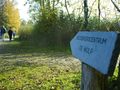
AzureMake an appointment - best with sturdy walking shoes on - at visitor center De Wulp of Natuurpunt. You start with the visitor center on your right and walk on a narrow asphalt road, only for walkers and cyclists. You cross the Smommerssloot and turn right with the asphalt road. Do not cross the Dommel, but turn left and follow the forked purple arrows. Via a bridge over an amphibian pond and then further between beautiful puddles and reed collars to a T-junction on a bird watching wall. Here you can observe the birds on the Municipal Pond. Our tour turns right. Cross the Dommel and follow it to the left. On this blissful path along the river you come to a viewing platform, with a beautiful view of the Dommel and the Gemeentevijver. Then continue to the observation tower, with another beautiful view of the large pond and the Dommel. Those who have binoculars with them can enjoy it twice. A little further on you come to a barrier with a sasje. Walk through it and cross the Dommel, via the concrete bridge. Step through the swinging door back into the nature reserve, still with the forked purple arrows of the Wrong-Lord's Path. 3 2 1 V A sign already warned that the blue and yellow paths are prohibited and impassable for the time being, due to works to restore the nature reserve as shown in an aerial photograph from 1936. This applies to some of these walks that are in the middle of the excavation work. The wide dirt road, over which you are now walking, also goes through the 'recovery area' and the yellow path also passes here, but there is still a lot of walking. Continue through the moorland, past border marker 185 to the edge of the forest. This is where the path splits. Choose on the right, into the forest. From now on, follow the forked red arrows. The yellow path also goes that way. The forest road touches the open heathland for a while and then turns away from it for good. Along the way there are signs about the repair works of the heath that can come to this road. At the fork, where the yellow walk goes to the right and the blue one looks for your path, you walk straight ahead, still with the forked red arrows and from now on also the blue ones. About 100 m further you take the first forest road on the right, until you reach a barrier. Step through the swinging door and follow the path on the left, next to a meadow with Galloway cattle. You step past a lock that regulates the flow of a stream and up to a T-junction. Turn left, past some meadows, again towards the forest. Ignore the drive back into the nature reserve on the left and drive to the Luikerweg on the right. Turn left with the forest road and turn right at the T-junction until you reach the parking lot of the Werkschuur van Natuurmonumenten. Here you turn left, again into the nature reserve. Keep following the forked red arrows for a while. When the forest stops, you step further along meadows and cross the border again unnoticed. Don't worry about side roads and climb over a ball bridge. After the descent, the red Vloeiweidenpad turns left through the swinging door. You continue straight ahead and again follow the forked purple arrows of the WrongLord's path. Continue walking along the nature reserve, ignore a road on the right and follow an asphalt road, which becomes car-free and also narrower further on through a pole. At the Wrong-Lord - his head rests on the left shoulder, while that is normally on the right - you turn left and step back into the nature reserve. At a barrier, take the dirt road on the left. At the end, follow the asphalt road 50 m to the right until the starting point.
Hai notato qualcosa su questo itinerario?Aggiungere un problema
Naviga nel percorso in...
![]() App RouteYou Aprire
App RouteYou Aprire
![]()
Attendi, la tua stampa è in preparazione.
La tua stampa è pronta per il download. Buon divertimento in viaggio!
Elaborazione della richiesta non è riuscita. Si prega di riprovare.
<iframe src="https://plugin.routeyou.com/routeviewer/free/?language=it&params.route.id=5367073&params.language=en" width="100%" height="600" frameborder="0" allowfullscreen></iframe>
<p><a class="routeYou_embed" href="https://app.routeyou.com/en-be/route/view/5367073?utm_source=embed&utm_medium=article&utm_campaign=routeshare&navigation=external" title="The Hageven in Neerpelt - RouteYou" target="_blank"><img src="https://image.routeyou.com/embed/route/960x670/5367073-en@2x.png" style="width: 100%; height: auto;" alt="The Hageven in Neerpelt"></a></p>
Altri commenti:
Questa funzionalità è disponibile esclusivamente per gli abbonati a RouteYou PREMIUM.
Prova 1 mese gratis e scopri la differenza! Non prendiamo alcun dettaglio di pagamento e la tua prova termina automaticamente dopo un mese.
© 2006-2026 RouteYou - www.routeyou.com