
Mira las fotos de esta caminata
Actualización 20-09-2022: Hicimos esta caminata nuevamente. Todos los senderos son accesibles.
°°°°°°°°°°°°°°°
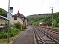
Esta es sin duda una caminata para caminantes experimentados. Se puede comenzar en la iglesia de ‘Bourscheid’ para descender por la ‘pista cicable de la Sûre Moyenne’ hasta ‘Goebelsmühle’ donde se cruza el ‘Sûre’. La caminata continúa a lo largo de la estación de ‘Goebelsmühle’ donde los amantes del transporte público pueden comenzar su recorrido. A través de senderos estrechos se camina por la ladera del ‘Sûre’ para luego descender unos kilómetros más hasta el pequeño pueblo de ‘Unterschlinder’.
A lo largo del ‘Sûre’ seguimos la N27 durante aproximadamente 300 metros para luego volver a ascender por la ladera hasta el pueblito de ‘Lipperscheid’. De ‘Lipperscheid’ se avanza hacia ‘Michelau’. En el camino se puede disfrutar de las hermosas vistas del valle del ‘Sûre’, el castillo de ‘Bourscheid’, ‘Bourscheid’ mismo y, por supuesto, la hermosa naturaleza que está presente aquí. En ‘Michelau’, se vuelve a cruzar el ‘Sûre’ a través de un puente peatonal que está junto a un puente ferroviario. Desde este punto hay una considerable subida hasta ‘Bourscheid’.
La caminata pasa en este último tramo por el castillo de ‘Bourscheid’ que definitivamente vale la pena visitar. Si todavía tienes ganas, por supuesto. ¿No tienes ganas? No importa, ya está ahí desde el siglo XI y seguirá estando por unos días más.
See something wrong on this route?Add an issue
Navigate route in...
 RouteYou app Open
Don't want to see this ad anymore?
→ Upgrade now

Please wait, the navigation is being prepared.
You can now navigate. Have fun on the road!
Processing your request has failed. Please try again.
Don't want to see this ad anymore?
→ Upgrade now
Please wait, your download is being prepared.
Your download is ready. Have fun on the road!
Processing your request has failed. Please try again.
Don't want to see this ad anymore?
→ Upgrade now
Please wait, your print is being prepared.
Your print is ready to download. Have fun on the road!
Processing your request has failed. Please try again.
<iframe src="https://plugin.routeyou.com/routeviewer/free/?language=en&params.route.id=1883318&params.language=es" width="100%" height="600" frameborder="0" allowfullscreen></iframe>
<p><a class="routeYou_embed" href="https://app.routeyou.com/es-lu/route/view/1883318?utm_source=embed&utm_medium=article&utm_campaign=routeshare&navigation=external" title="Bourscheid 18.8 km - RouteYou" target="_blank"><img src="https://image.routeyou.com/embed/route/960x670/1883318-es@2x.png" style="width: 100%; height: auto;" alt="Bourscheid 18.8 km"></a></p>
Additional feedback:
This feature is only available to RouteYou PREMIUM subscribers.
Try 1 month for free and discover the difference! We don't take any payment details, and your trial ends automatically after one month.
© 2006-2026 RouteYou - www.routeyou.com



 Eddy&Rita






 Start
Start Download
 Download

