Link copiato. Incolli il link su Instagram per condividere l'itinerario.

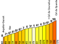
Subito dopo la partenza dal centro di Argelès-Gazost, si sale in collina. Prendi i primi 500 metri del Col du Soulor, ma presto gira a destra verso Gez. Qui inizi la salita del Col des Spandelles (1.378m). Buono per 15,5 chilometri di salita con una pendenza media del 6,0%. Ma non farti ingannare, questa ripida e irregolare salita boschiva
raggiunge punte del 13%! Dalla cima hai una
vista impressionante sulla valle che ti aspetta. La discesa è un piacere per chi ama le curve brevi. Con tempo umido bisogna stare attenti. Una volta arrivato nel paesino di Ferrières hai appena il tempo di riprendere fiato, perché inizi subito la salita
del Col du Soulor. Il Col du Soulor è uno dei famosi colli dei Pirenei frequentati dal Tour de France. Il lato nord del Soulor è lungo 12 chilometri ed è una salita molto uniforme con una media dell'8%. Completamente diversa rispetto alle Spandelles di prima. Negli ultimi 5 chilometri ti viene presentato un panorama fantastico. Se guardi a destra, puoi persino vedere la strada che porta alla cima dell'Aubisque. Durante la salita e sulla cima del Soulor (1.474m) noterai diversi tipi di bestiame al pascolo. Non c'è bisogno di preoccuparsi, sono totalmente innocui. Chi riesce a raggiungere la cima del Soulor senza troppi problemi, può riprendersi un attimo e fare anche la corsa fino alla cima dell'Aubisque (1.709m). Dalla
cima del Soulor, l'Aubisque è relativamente facile da raggiungere. Mancano solo 10 chilometri, dei quali solo gli ultimi 4 chilometri possono essere considerati "salita". Il Col d'Aubisque è uno dei classici colli del Tour de France, ed è stato conquistato per la prima volta da un belga, tra cui Eddy Merckx e Lucien Van Impe, per dodici volte.
Hai notato qualcosa su questo itinerario?Aggiungere un problema
Naviga nel percorso in...
 App RouteYou Aprire
Vuoi smettere di vedere questo annuncio?
→ Upgrade ora

Attendi, la navigazione è in preparazione.
Ora puoi navigare. Buon divertimento in viaggio!
Elaborazione della richiesta non è riuscita. Si prega di riprovare.
Vuoi smettere di vedere questo annuncio?
→ Upgrade ora
Attendi, il tuo download è in preparazione.
Il tuo download è pronto. Buon divertimento in viaggio!
Elaborazione della richiesta non è riuscita. Si prega di riprovare.
Vuoi smettere di vedere questo annuncio?
→ Upgrade ora
Attendi, la tua stampa è in preparazione.
La tua stampa è pronta per il download. Buon divertimento in viaggio!
Elaborazione della richiesta non è riuscita. Si prega di riprovare.
Altri commenti:
Questa funzionalità è disponibile esclusivamente per gli abbonati a RouteYou PREMIUM.
Prova 1 mese gratis e scopri la differenza! Non prendiamo alcun dettaglio di pagamento e la tua prova termina automaticamente dopo un mese.
© 2006-2026 RouteYou - www.routeyou.com



 BDST
BDST






 Comincia
 Scarica
 Scarica

