12049 views | Public | Dutch
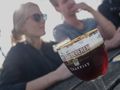
From the car park at the Sint-Sixtus Abbey (V) and meeting centre In de Vrede in Westvleteren - the only place where the famous Trappist is donated; The abbey and the brewery itself are not accessible - you walk along the abbey wall to junction 8. • Opposite the Sint-Sixtusschooltje (1840) you step into the lane and walk towards 7 and to the Lourdes grotto 1. It was built in 1921 by the monks out of gratitude, because their abbey came out of WWI unscathed. Just before you arrive at the Lourdes Grotto, turn right and then turn left with the path and walk up to an asphalt road. Follow it to the left until junction 7. • Turn left, direction 18. Immediately turn right and ignore the Kooiaardstraat and continue walking on a traffic-calmed asphalt road through the open landscape. You step past a farmhouse with a brick chapel, turn right with the road and then turn left into the first street. 200 m further on, at junction 18 you turn right onto a field road, towards bosrand and junction 19. You first step next to, then a bit through the forest and arrive at junction 19. Turn left, 200 m through the forest to junction 20. Turn right here, along the edge of the forest, direction 21. • You walk past the British military cemetery Dozinghem 2. 3,239 fallen from 'the Great War' and 73 from WWII are buried here. Dozinghem refers to 'to dose', the administration of medicines in dosed quantities. Nearby, in preparation for the Third Battle of Ypres (1917), a number of military field hospitals (casualty clearing stations or c.c.s) were set up. The cemetery was used for nine months, until the German Spring Offensive in the spring of 1918. • Continue walking to the edge of the forest. There, turn left until you reach junction 21. Turn right, direction 28, over a wide forest road to an asphalt road. Cross it and continue walking through the forest to the T-junction. Turn left and also on the next T turn left and then right past tavern-restaurant 't Jagershof until junction 28. • Turn right until junction 26 in the bend of the asphalt road. Step through a sasje into the forest and follow the path to junction 25. The Sint-Sixtusroute, which you have been following all the time, goes straight ahead here. You turn right, direction 30. Get on the first forest road on the right and at junction 30 turn left, direction 31. Step through the sasje and follow the path until you come back to the Canadaweg. Follow it to the right. You walk past the rural inn Canada, located in a homestead from 1878. You are now halfway there and can go here for regional beers, sandwiches, pancakes and the aperitif of the house, the 'pap bottle', served in a real baby bottle. • Continue walking to junction 31. Turn left into Canonstraat and follow it to junction 32. Here you choose direction 33. • Enter Domain De Lovie 3. The castle was built in 1856. During WWI it was a headquarters of French and English army corps. Currently, it is a center for the guidance of persons with intellectual disabilities. Keep a close eye on the signage and walk through the beautiful English garden, past ponds, over lawns, through a grove and climb to the gazebo on the Drogenbroodberg. By 1868, harvests had failed and there was a lot of unemployment. The lords of the castle had the Mountain of Mercy built by the unemployed with land from the ponds. They received one loaf of bread as payment and therefore called the mountain Drogenbroodberg. • At node 33, leave the domain and turn left until node 24. Right. Walk along a field road past junction 23 and hop fields to junction 16. Turn right again and at junction 15 turn left into Sint-Sixtdreef. On the T, follow the Koekuitstraat to the right until junction 14. Take the narrow tile path on the left, direction 8. At the end you follow the Donkerstraat to the abbey.
Navigate route in...
![]() RouteYou app Open
RouteYou app Open
Don't want to see this ad anymore?
→ Upgrade now
![]()
Please wait, the navigation is being prepared.
You can now navigate. Have fun on the road!
Processing your request has failed. Please try again.
Don't want to see this ad anymore?
→ Upgrade now
![]()
Please wait, your download is being prepared.
Your download is ready. Have fun on the road!
Processing your request has failed. Please try again.
Don't want to see this ad anymore?
→ Upgrade now
![]()
Please wait, your print is being prepared.
Your print is ready to download. Have fun on the road!
Processing your request has failed. Please try again.
Don't want to see this ad anymore?
→ Upgrade now
![]()
Please wait, your download is being prepared.
Your download is ready. Have fun on the road!
Processing your request has failed. Please try again.
<iframe src="https://plugin.routeyou.com/routeviewer/free/?language=en&params.route.id=5342962" width="100%" height="600" frameborder="0" allowfullscreen></iframe>
<a href="https://www.routeyou.com/en-be/route/view/5342962/recreational-walking-route/through-the-lanes-in-westvleteren?utm_source=embed&utm_medium=article&utm_campaign=routeshare" title="Through the lanes in Westvleteren - RouteYou" target="_blank"><img src="https://image.routeyou.com/embed/route/960x670/5342962-en@2x.png" width="960" height="670" alt="Through the lanes in Westvleteren"></a>
Additional feedback:
Try this feature for free with a RouteYou Plus trial subscription.
If you already have such an account, then log in now.
Try this feature for free with a RouteYou Premium trial subscription.
© 2006-2024 RouteYou - www.routeyou.com