Doolin Cycle Hub - Loop 1

Show mapNavigatePrintDownloadEdit
Advertisement
Advertisement
17.1 km
264 m
01h08
Medium

View on interactive map

Route information

1087 views | Public

Description by the author

More information on Openstreetmap.
Inspired by OSM.

Advertisement

Route origin

Route description

Region

Statistics

Difficulty level: Medium (53/100)
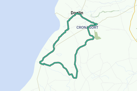
Length: 17.1 km

Duration: 01h08


Total ascent: 264 m

Maximal slope: 3.3 %

Average slope: 1.5 %

Net ascent: 1 m

Total descent: 263 m

Roads and subsoil

Paved roads: 12.7 km (74 %)

Cobblestones: 0 m (0 %)

Bike paths: 0 m (0 %)

Scenery

Car free roads: 0 m (0 %)

Noise pollution

Amount of traffic


Natural area

Urban area

Water rich area

Characteristics

    Themes

      Groups

        Start and end of the route

        Closest address to start: R459, Clare, Ireland
        Closest address to end: R479, Clare, Ireland

        Navigate to starting point

        Places of interest

        1. Doolin

          0 · Village
          Doolin is a coastal village in County Clare, Ireland, on the Atlantic coast. It is southwest of …
          Wikipedia
        2. Aille River

          0 · River
          The Aille River in County Clare in Ireland rises on the slopes of Slieve Elva in the Burren. It …
          Wikipedia
        3. Doonagore Castle

          0 · Castle
          Doonagore Castle is a round 16th-century tower house with a small walled enclosure located about 1 …
          Wikipedia

        Interesting products for your trip

        Advertisement

        Comments

        Activities

        Nearby

        Routes nearby

        Lodging nearby

        Services nearby

        Doolin
        Aille River
        Doonagore Castle
        0 km1 km2 km3 km4 km5 km6 km7 km8 km9 km10 km11 km12 km13 km14 km15 km16 km17 km17 km12 m189 m
        Plus
        500 m

        © 2006-2025 RouteYou - www.routeyou.com