

The 'Engelbamp' is a historical road trace and hollow way. This road appears on historical maps from the 17th century but likely originates from the early Middle Ages. It is believed to have been constructed in the early Middle Ages as an extension of a Roman road from Huy over Landen-Velm and Sint-Truiden. Along this route, the Abbey of Sint-Truiden established its summer residence and farm Nieuwenhoven. Here you will also find a viewpoint at the top of the shoulder of the hollow way where you can admire the skyline of Sint-Truiden.
 | | Pública | Alemany • Danès • Espanyol • Francès • Italià • Neerlandès

Seleccioneu una de les activitats més populars a continuació o perfeccioneu la cerca.
Descobriu les rutes més boniques i conegudes de la zona, acuradament agrupades en seleccions adequades.
Seleccioneu una de les categories més populars a continuació o inspira't en les nostres seleccions.
Descobriu els llocs d'interès més bonics i coneguts de la zona, acuradament agrupats en seleccions adequades.
Amb RouteYou pots crear mapes personalitzats molt fàcilment. Defineix la teva ruta, afegeix waypoints o interseccions, planifica parades a punts d'interès o a establiments per menjar i beure i comparteix-ho tot amb els amics i la família.
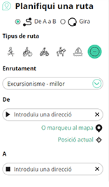
Planificador de rutes
<iframe src="https://plugin.routeyou.com/poiviewer/free/?language=ca&params.poi.id=8144804&params.language=en" width="100%" height="600" frameborder="0" allowfullscreen></iframe>

Més de 11.800.000 rutes

Més de 15.000.000 usuaris

Més de 4.500.000 llocs d'interès

Kerkstraat 108
9050 Gentbrugge, Bèlgica
© 2006-2026 RouteYou - www.routeyou.com



