17565 gange set | Offentlig | Fransk • Nederlandsk • Tysk
 Azure
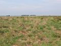
AzureThis route is plotted in the sandy landscape of the Northern Netherlands. The route runs largely through the central sandy area of Drenthe, also called the Drents Plateau.
The northern sandy area is a fairly low, sloping area with hills in a few places. In the penultimate ice age, the Scandinavian land ice came to the Haarlem-Utrecht-Nijmegen line. Under these glaciers, a ground moraine was deposited, the so-called boulder loam.
In the last ice age (Weichselien) there was no land ice in the Netherlands, but there was a subarctic climate. The soil was permanently frozen (permafrost) and there was little or no plant growth. Due to icy sandstorms, layers of deck sand were deposited.
In areas where boulder loam is on the surface, drainage is often limited, causing peat bogs.
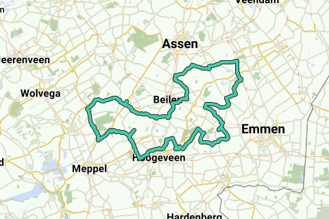
The tour starts and ends at exit 27 (Fluitenberg) of the A28 near Hoogeveen.
This tour is part of a set of 16 tours that are intended for everyone with an eye for (the development of) the Dutch landscape.
In the Netherlands, 6 landscapes can be distinguished: loess landscape, sandy landscape, river landscape, peat landscape, sea clay landscape and dune landscape. The different landscapes are explored through 16 tours with mention of all kinds of scenic and historical sights / facts.
For those who want to know more about the sights / facts mentioned in the routes, the routes are also available in book form.
For more information and an overview of all routes, see www.fjreedijk.nl/motorgeografie.
Har du lagt mærke til noget på denne rute?Tilføj et problem
Naviger ruten med...
![]() RouteYou app Åbn
RouteYou app Åbn
Vil du ikke se denne annonce mere?
→ Opgrader nu
![]()
Et øjeblik, navigationen forberedes.
Du kan nu navigere. God fornøjelse på vejen!
Behandlingen af anmodningen mislykkedes. Prøv venligst igen.
Vil du ikke se denne annonce mere?
→ Opgrader nu
![]()
Et øjeblik, din download forberedes.
Din download er klar. God fornøjelse på farten!
Behandlingen af anmodningen mislykkedes. Prøv venligst igen.
Vil du ikke se denne annonce mere?
→ Opgrader nu
![]()
Et øjeblik, din udskrift forberedes.
Din udskrift er klar til download. God fornøjelse på farten!
Behandlingen af anmodningen mislykkedes. Prøv venligst igen.
<iframe src="https://plugin.routeyou.com/routeviewer/free/?language=da&params.route.id=4195078&params.language=en" width="100%" height="600" frameborder="0" allowfullscreen></iframe>
<p><a class="routeYou_embed" href="https://app.routeyou.com/en-nl/route/view/4195078?utm_source=embed&utm_medium=article&utm_campaign=routeshare&navigation=external" title="Drents_Plateau - RouteYou" target="_blank"><img src="https://image.routeyou.com/embed/route/960x670/4195078-en@2x.png" style="width: 100%; height: auto;" alt="Drents_Plateau"></a></p>
Yderligere feedback:
Du skal mindst have en RouteYou PREMIUM-konto for at kunne bruge denne funktion.
Prøv nu 1 måned gratis og oplev forskellen! Vi beder ikke om betalingsoplysninger, og det stopper automatisk efter din prøveperiode på en måned.
© 2006-2025 RouteYou - www.routeyou.com