596 Aufrufe | Öffentlich | Deutsch • Französisch • Niederländisch
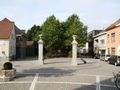
TERNAT - Walking between the water mills of Neer- and Opalfene
On Saturday 17/10/2020, the reopened footpath or slow road between the water mills of Neeralfene and Opalfene will be inaugurated. It is one of the achievements of the Steenvoordebeek project that was initiated in 2017 by the municipality in collaboration with the Regional Landscape Pajottenland & Zennevallei, the Agency for Nature and Forest, the Flanders Environment Agency, the province, and Natuurpunt.
The slow road will be extended to make the entire route from the center of Ternat to Sint-Martens-Bodegem accessible. Moreover, the site of the retention pond at the Neeralfenemolen – purchased by the Flanders Environment Agency – will be developed and made accessible. It will become an extra green resting place with picnic tables and fishing piers. The heritage orchard of Ternat, located along the route of the slow road, will also be renovated. Additional picnic tables, a more diverse planting scheme, and adapted management will be part of the refresh of this location. Furthermore, these two resting spots will gain a sibling: an additional resting area will be created at Heirbaan near the Opalfenemolen.
The mill domain is located at the old Nervian heirbaan 40 1740 Ternat. Across from the Heirbaan once lay the mill pond containing a fortified establishment or motte. It was reportedly destroyed during the religious wars in the 17th century, and the inhabitants were massacred. The site is now a natural domain managed by Natuurpunt and the municipality of Ternat. Under the Heirbaan, there is a small bridge with a barrel vault that may date back to the Roman period. The mill was first mentioned in a deed in 1378. More information about the mill's history can be found at http://www.molenechos.org/molen.php?AdvSearch=999
On the 18th-century French military map of Villaret, you can clearly see the pond and the motte as well as the Moulin d’Aupalvene. A link to the Villaret maps of Ternat and Wambeek (Lombeek was not realized by the French) can be found at https://drive.google.com/open?id=0B9dAjd4-jXaOUTdXWVRCMk5nQnc
The mill was recently purchased by Edouard Labrue and his wife, who are actively involved in the restoration.
Mill at Neeralfene mill ten Berg Neeralfenestraat 1 1740 Ternat on the Steenvoordebek 500 meters from the church.
Hof ten Berg is a large square farm, situated on a hill east of the center of Ternat opposite the cemetery. It features a nice play of volumes with brick buildings under gable roofs (covered with tiles), grouped around a paved courtyard. The entrance gate is located on the east wing and under a wooden lintel. A single-storey farmhouse with eight bays under a gable roof is dated “Anno 1700” on a stone above the door. The white-painted front facade with a cemented base was provided around 1940 with a renewed door and rectangular windows with lowered lintels and new drip caps. The old sandstone posts from the niches were then retained. The rear facade has a rectangular door and barred windows with sandstone frames and niches, as well as three large, bricked-up rectangular windows. Internally, the construction of the beams and child beams was preserved, and elements from the original fireplace were reused: strongly vaulted supports made of polished hardstone.[1]
The field gate under a wooden lintel with posts of sandstone niches is located in the north with scaffolding holes and corner chains in the rear facade.
An older stable wing under a gable roof (tiles) equipped with rectangular doors and attic windows can be found in the south. In the southeast corner, an additional dwelling was established after the Second World War, with cemented facades facing the street.
Along the west side stood in 1973 a low brick pigsty with traces of frame construction. Next to it was a long barn made of brick with a gable roof covered in tiles. It was built in 1940 to replace the earthen barn.[2] In 2011, the farm was restored.
Enjoy your walk, Emiel Peeters
Ist Ihnen auf dieser Route etwas aufgefallen?Problem hinzufügen
Route navigieren in...
![]() RouteYou-App Öffnen
RouteYou-App Öffnen
Diese Werbung nicht mehr anzeigen?
→ Jetzt upgraden
![]()
Bitte warten Sie, die Navigation wird vorbereitet.
Sie können jetzt navigieren. Viel Routen-Spaß!
Bearbeitung Ihrer Anfrage ist fehlgeschlagen. Bitte versuchen Sie es erneut.
Diese Werbung nicht mehr anzeigen?
→ Jetzt upgraden
![]()
Bitte warten Sie, Ihr Download wird vorbereitet.
Ihr Download ist fertig. Viel Routen-Spaß!
Bearbeitung Ihrer Anfrage ist fehlgeschlagen. Bitte versuchen Sie es erneut.
Diese Werbung nicht mehr anzeigen?
→ Jetzt upgraden
![]()
Bitte warten Sie, Ihr Ausdruck wird vorbereitet.
Ihr Ausdruck ist bereit für den Download. Viel Routen-Spaß!
Bearbeitung Ihrer Anfrage ist fehlgeschlagen. Bitte versuchen Sie es erneut.
<iframe src="https://plugin.routeyou.com/routeviewer/free/?language=de&params.route.id=8941845&params.language=en" width="100%" height="600" frameborder="0" allowfullscreen></iframe>
<p><a class="routeYou_embed" href="https://app.routeyou.com/en-be/route/view/8941845?utm_source=embed&utm_medium=article&utm_campaign=routeshare&navigation=external" title="Walking between water mills Neer and Opalfene 5km - RouteYou" target="_blank"><img src="https://image.routeyou.com/embed/route/960x670/8941845-en@2x.png" style="width: 100%; height: auto;" alt="Walking between water mills Neer and Opalfene 5km"></a></p>
Zusätzliches Feedback:
Diese Funktion ist ausschließlich für RouteYou PREMIUM-Abonnenten verfügbar.
Testen Sie 1 Monat kostenlos und entdecken Sie den Unterschied! Wir erfassen keine Zahlungsdaten und Ihre Testversion endet automatisch nach einem Monat.
© 2006-2026 RouteYou - www.routeyou.com