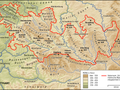
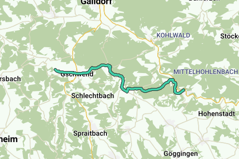
Erlebe die atemberaubende Natur entlang der Nebenlinie des SAV (rotes Plus) in Baden-Württemberg, nahe dem Welzheimer Wald. Auf einer Strecke von 21,7 Kilometern wanderst du durch malerische Landschaften und genießt die Ruhe des Wassers, während du insgesamt 511 Höhenmeter meisterst. Die mittelschwere Route führt dich vorbei an charmanten Orten wie Gschwend und bietet einen herrlichen Blick von der Frickenhofer Höhe. Die Wege sind gut beschildert, sodass du dich ganz auf die Schönheit der Umgebung konzentrieren kannst. Ideal für alle, die Natur und Abenteuer lieben.
See something wrong on this route?Add an issue
Navigate route in...
![]() RouteYou app Open
RouteYou app Open
Don't want to see this ad anymore?
→ Upgrade now
![]()
Please wait, the navigation is being prepared.
You can now navigate. Have fun on the road!
Processing your request has failed. Please try again.
Don't want to see this ad anymore?
→ Upgrade now
![]()
Please wait, your download is being prepared.
Your download is ready. Have fun on the road!
Processing your request has failed. Please try again.
Don't want to see this ad anymore?
→ Upgrade now
![]()
Please wait, your print is being prepared.
Your print is ready to download. Have fun on the road!
Processing your request has failed. Please try again.
<iframe src="https://plugin.routeyou.com/routeviewer/free/?language=en&params.route.id=4376911&params.language=de" width="100%" height="600" frameborder="0" allowfullscreen></iframe>
<p><a class="routeYou_embed" href="https://app.routeyou.com/de-de/route/view/4376911?utm_source=embed&utm_medium=article&utm_campaign=routeshare&navigation=external" title="Nebenlinie des SAV (rotes Plus) - RouteYou" target="_blank"><img src="https://image.routeyou.com/embed/route/960x670/4376911-de@2x.png" style="width: 100%; height: auto;" alt="Nebenlinie des SAV (rotes Plus)"></a></p>
Additional feedback:
This feature is only available to RouteYou PREMIUM subscribers.
Try 1 month for free and discover the difference! We don't take any payment details, and your trial ends automatically after one month.
© 2006-2026 RouteYou - www.routeyou.com