Source: Sandy Berthomieu
Copyright: All rights reserved


Das Dorf liegt am Tor zu den Gorges du Tarn und Jonte, wo die beiden Flüsse zusammenfließen. Sein Name stammt von den Rosenkulturen der Mönche der Abtei von Aniane, die 1705 die Kirche Saint-Sauveur erbauten. Rundherum bauten sie Rosen an. Der Ort erhielt den Namen "Campus Rosarium". Im Okzitanischen wurde er "Lou Rousio" genannt, heute heißt er "Le Rozier". Heute ist von dem Kloster nur noch die Kirche übrig geblieben.
Gegenüber von Le Rozier, auf der anderen Seite des Flusses Jonte, liegt das Dorf Peyreleau, das sich im Département Aveyron befindet und Ausgangspunkt für die Causse Noir ist. Das Dorf ist am linken Ufer des Flusses gestaffelt und wird von einem alten quadratischen Turm überragt, dem letzten Überbleibsel der alten Festung.
Source: 48-CDT48
Copyright: Creative Commons CC BY 2.0
 | | Public | Danish • Dutch • English • French • Italian • Spanish
Address: 48150 Le Rozier
Statistics
Select one of the most popular activities below or refine your search.
Discover the most beautiful and popular trails in the area, carefully bundled into appropriate selections.
Source: Sandy Berthomieu
Copyright: All rights reserved
Select one of the most popular categories below or be inspired by our selections.
Discover the most beautiful and popular attractions in the area, carefully bundled in appropriate selections.
Source: Sandy Berthomieu
Copyright: All rights reserved
With RouteYou, it's easy to create your own customised maps. Simply plot your route, add waypoints or nodes, add places of interest and places to eat and drink, and then easily share it with your family and friends.
Route planner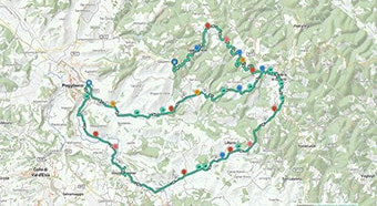
<iframe src="https://plugin.routeyou.com/poiviewer/free/?language=en&params.poi.id=8960771&params.language=de" width="100%" height="600" frameborder="0" allowfullscreen></iframe>

More than 11,800,000 routes

More than 15,000,000 users

More than 4,500,000 points of interest

Kerkstraat 108
9050 Gentbrugge, Belgium
© 2006-2026 RouteYou - www.routeyou.com



