
Link copied. Paste the link into Instagram to share the route.

Esta es la versión grande de "The19DemarcationsStones". En esta versión también se garantiza un camino de regreso a Nieuwpoort que está diseñado para que se pueda conducir rápidamente y recorrer la distancia total en un solo día.
Esta ruta conecta los 19 hitos de demarcación que aún quedan en Bélgica. Dado que estos hitos son el tema principal de la ruta, que ya es bastante larga, opté por no hacer desvíos adicionales para visitar otros lugares de interés (a veces muy interesantes).
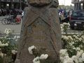
Estos hitos de demarcación son piedras conmemorativas que indican aproximadamente hasta dónde se extendió el frente occidental alemán durante la Primera Guerra Mundial. Son piedras de granito rosado de 1,25 metros de altura. En la parte superior se representa un casco de soldado, descansando sobre una corona de laurel con el nombre del sector del frente. En las 4 esquinas se representa una granada, a la izquierda una cantimplora y a la derecha una máscara de gas.
En Bélgica hay tres variantes. El tipo belga tiene un casco adriano belga con una cabeza de león, el tipo francés un casco adriano francés con la inscripción RF y el tipo británico un casco brodie británico.
Si se han conservado las inscripciones, se puede leer el siguiente texto (en 3 idiomas):
"Aquí se detuvo al invasor - Ici fut arrêté l'envahisseur - Here the invader was brought to a standstill".
La ruta comienza en Nieuwpoort y termina en Loker, cerca de la frontera francesa. Aproximadamente, se conduce a lo largo del frente de la Primera Guerra Mundial.
See something wrong on this route?Add an issue
Navigate route in...
 RouteYou app Open
Don't want to see this ad anymore?
→ Upgrade now

Please wait, the navigation is being prepared.
You can now navigate. Have fun on the road!
Processing your request has failed. Please try again.
Don't want to see this ad anymore?
→ Upgrade now
Please wait, your download is being prepared.
Your download is ready. Have fun on the road!
Processing your request has failed. Please try again.
Don't want to see this ad anymore?
→ Upgrade now
Please wait, your print is being prepared.
Your print is ready to download. Have fun on the road!
Processing your request has failed. Please try again.
Additional feedback:
This feature is only available to RouteYou PREMIUM subscribers.
Try 1 month for free and discover the difference! We don't take any payment details, and your trial ends automatically after one month.
© 2006-2026 RouteYou - www.routeyou.com



 MarcMonballieu






 Start
Start Download
 Download

