Source: Sandy Berthomieu
Copyright: All rights reserved


Situado a las puertas de las gargantas del Tarn y del Jonte, en la confluencia de ambos ríos, el pueblo toma su nombre de los rosales cultivados por los monjes de la abadía de Aniane, que construyeron la iglesia de Saint-Sauveur en 1705. Cultivaban rosas por todo el pueblo. La zona pasó a conocerse como "Campus Rosarium". Conocido en occitano como "Lou Rousio", actualmente se llama "Le Rozier". Del monasterio sólo queda la iglesia.
Frente a Le Rozier, al otro lado de la Jonte, se encuentra el pueblo de Peyreleau, en Aveyron, punto de partida del Causse Noir. El pueblo se encuentra en la orilla izquierda del río, dominado por una antigua torre cuadrada, último vestigio del antiguo castillo fortificado.
Source: 48-CDT48
Copyright: Creative Commons CC BY 2.0
 | | Public | Danish • Dutch • English • French • German • Italian
Address: 48150 Le Rozier
Statistics
Select one of the most popular activities below or refine your search.
Discover the most beautiful and popular trails in the area, carefully bundled into appropriate selections.
Source: Sandy Berthomieu
Copyright: All rights reserved
Select one of the most popular categories below or be inspired by our selections.
Discover the most beautiful and popular attractions in the area, carefully bundled in appropriate selections.
Source: Sandy Berthomieu
Copyright: All rights reserved
With RouteYou, it's easy to create your own customised maps. Simply plot your route, add waypoints or nodes, add places of interest and places to eat and drink, and then easily share it with your family and friends.
Route planner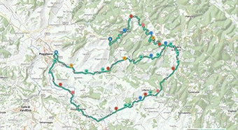
<iframe src="https://plugin.routeyou.com/poiviewer/free/?language=en&params.poi.id=8960771&params.language=es" width="100%" height="600" frameborder="0" allowfullscreen></iframe>

More than 11,800,000 routes

More than 15,000,000 users

More than 4,500,000 points of interest

Kerkstraat 108
9050 Gentbrugge, Belgium
© 2006-2026 RouteYou - www.routeyou.com



