Link copied. Paste the link into Instagram to share the route.

Pista de jogging agradable con suficiente aparcamiento en el lado norte.
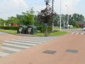
La distancia exacta es de 1550 m, casi 1 milla (1609 m), medida con una bicicleta calibrada en el interior del sendero (y el camino más corto entre curvas). Por el lado sur, debes dejar el panel de información y el contenedor de basura a la izquierda si caminas en sentido antihorario; así que sube la colina hasta detrás de los árboles y el contenedor, y no tomes el atajo.
Al noreste y sureste hay posibilidad de hacer picnic. Al este hay un mirador de aves (sigue los pilotes). Desde las cuatro direcciones hay una hermosa vista del estanque.
En días muy húmedos, a veces puede estar resbaladizo en la curva norte.
Si haces el bucle en sentido antihorario, la dirección de la caminata (corta) hacia el sur es en su mayor parte cuesta arriba. La dirección de la caminata (más larga) hacia el norte tiene entonces dos pendientes cortas.
See something wrong on this route?Add an issue
Navigate route in...
 RouteYou app Open
Don't want to see this ad anymore?
→ Upgrade now

Please wait, the navigation is being prepared.
You can now navigate. Have fun on the road!
Processing your request has failed. Please try again.
Don't want to see this ad anymore?
→ Upgrade now
Please wait, your download is being prepared.
Your download is ready. Have fun on the road!
Processing your request has failed. Please try again.
Don't want to see this ad anymore?
→ Upgrade now
Please wait, your print is being prepared.
Your print is ready to download. Have fun on the road!
Processing your request has failed. Please try again.
Additional feedback:
This feature is only available to RouteYou PREMIUM subscribers.
Try 1 month for free and discover the difference! We don't take any payment details, and your trial ends automatically after one month.
© 2006-2026 RouteYou - www.routeyou.com


 wy




 Start
 Download
 Download


