Link copied. Paste the link into Instagram to share the route.

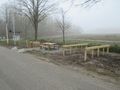
Per chiudere ermeticamente il confine tra il Belgio occupato e i Paesi Bassi "neutrali" durante la Prima Guerra Mondiale, da un lato alla costa fino a Aquisgrana, c'era una barriera elettrica con alta tensione: il Filo della Morte. L'elettricità era abbastanza sconosciuta nelle Fiandre. Solo negli anni '20 del 1900 venne realizzata la rete elettrica. Già presto gli abitanti delle Fiandre si resero conto che il filo non era solo una barriera, ma anche un temibile arma. Centinaia di persone sono state elettrocutate durante i tentativi di fuga (o a causa di altre cause) tra il 1915 e il 1918. Durante questa passeggiata passeremo accanto a una delle ricostruzioni del Filo della Morte e a un edificio di comando ricostruito. Chi vuole saperne di più può visitare http://www.dodendraad.org/ È stato anche pubblicato un libro molto interessante sul Filo della Morte: 'Alta tensione al confine belgo-olandese'.
See something wrong on this route?Add an issue
Navigate route in...
 RouteYou app Open
Don't want to see this ad anymore?
→ Upgrade now

Please wait, the navigation is being prepared.
You can now navigate. Have fun on the road!
Processing your request has failed. Please try again.
Don't want to see this ad anymore?
→ Upgrade now
Please wait, your download is being prepared.
Your download is ready. Have fun on the road!
Processing your request has failed. Please try again.
Don't want to see this ad anymore?
→ Upgrade now
Please wait, your print is being prepared.
Your print is ready to download. Have fun on the road!
Processing your request has failed. Please try again.
Additional feedback:
This feature is only available to RouteYou PREMIUM subscribers.
Try 1 month for free and discover the difference! We don't take any payment details, and your trial ends automatically after one month.
© 2006-2026 RouteYou - www.routeyou.com



 Edwin Hermans






 Start
Start Download
 Download

