

Thanks to our partner Gemeente Kortenberg you get free access to this route – and make your acquaintance with RouteYou PLUS.
Discover all benefits
La passeggiata di Keizerdelle deve il suo nome alla Keizerdelle, uno dei complessi di terreni tra Steenokkerzeel, Berg, Nederokkerzeel e Peperstraat a Erps-Kwerps. In linguaggio colloquiale si parla di Kasdel. Il nome Keizerdelle o la valle della famiglia De Keyzer che probabilmente era proprietaria di questi terreni.
Prima di iniziare la passeggiata, possiamo fare un giro attorno alla chiesa e dare un'occhiata ad alcuni edifici interessanti.
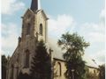
Partiamo dalla chiesa di Sint Amandus di Erps. Attraversiamo la piazza del villaggio e entriamo in Kammestraat. A 200 m più avanti, sulla nostra sinistra, vediamo la Kam o birreria di Jan van Ransem. Circa 250 m dopo l'incrocio con la Dreef, svoltiamo a destra nel sentiero 63 che collega Kammestraat con Frans Mombaersstraat. Svoltiamo lì a sinistra e camminiamo quasi fino alla Mechelsesteenweg.
Prima di raggiungere la rotonda, sulla nostra destra vediamo la cappella del Bambino Gesù di Praga. Qui svoltiamo a destra nel sentiero 11 che in linguaggio colloquiale viene chiamata la strada per Vosseputten. Questa strada passa accanto alla cappella e diventa una bella strada in discesa. Questa strada incrocia prima il prolungamento di Curegemstraat, poi Vosseputten dove notiamo alcune chalet. 200 m più avanti, svoltiamo a destra nel sentiero 10 che si trasforma in Keizerdellestraat.
Se già ci sentiamo stanchi, proseguiamo fino a Peperstraat. Se svoltiamo a sinistra, raggiungiamo di nuovo rapidamente la piazza del villaggio da cui siamo partiti.
Se siamo ancora in forma, svoltiamo a sinistra nel sentiero 66 che va verso Dorenbaan. Su Dorenbaan si trova la cappella di Sint Rochus. Svoltiamo a sinistra nel sentiero 4 dove, dopo quasi 900 m, svoltiamo a destra nel sentiero 6 o Lindekensweg. Questa strada si immette sulla Nederokkerzeelsesteenweg proprio di fronte a Kasteelstraat. Andiamo a destra e di fronte a Oudebaan vediamo la cappella del Sacro Cuore di Gesù. Un po' più avanti, in Peperstraat, si trova la Van Hammehuis.
Lungo l'ex municipio di Erps-Kwerps raggiungiamo di nuovo la piazza del villaggio da cui siamo partiti.
See something wrong on this route?Add an issue
Navigate route in...
 RouteYou app Open

Please wait, your print is being prepared.
Your print is ready to download. Have fun on the road!
Processing your request has failed. Please try again.
<iframe src="https://plugin.routeyou.com/routeviewer/free/?language=en&params.route.id=169959&params.language=it" width="100%" height="600" frameborder="0" allowfullscreen></iframe>
<p><a class="routeYou_embed" href="https://app.routeyou.com/it-be/route/view/169959?utm_source=embed&utm_medium=article&utm_campaign=routeshare&navigation=external" title="Passeggiata Keizerdelle - RouteYou" target="_blank"><img src="https://image.routeyou.com/embed/route/960x670/169959-it@2x.png" style="width: 100%; height: auto;" alt="Passeggiata Keizerdelle"></a></p>
Additional feedback:
This feature is only available to RouteYou PREMIUM subscribers.
Try 1 month for free and discover the difference! We don't take any payment details, and your trial ends automatically after one month.
© 2006-2026 RouteYou - www.routeyou.com



 Gemeente Kortenberg






 Download


