Link copied. Paste the link into Instagram to share the route.

Questo anello/traccia MTB corre interamente sul lato ovest dell'E19 a Zemst e passa vicino a Vilvoorde.
È un percorso di circa 25 km, creato per mountain biker, situato a Zemst e in parte a Vilvoorde (in e intorno a Houtem).
Sul sito MTB è presente anche questo anello (https://www.routeyou.com/nl/route/view/680525/mountainbikeroute/mtb-zemst-groene-lus.nl), ma anche in questa tracciatura ci sono vari errori registrati. Questi sono stati segnalati, ma sia nei pannelli ai punti di partenza (ad esempio qui: Pannello informativo che si trova a Houtem (Vilvoorde): https://www.routeyou.com/nl/location/view/47929192/informatiebord-mtb-lus-zemst-te-houtem-hier-komt-de-groene-lus-langs.nl) che nella tracciatura GPX, questi errori rimangono. Quindi non usarli e segui quelli corretti qui.
Per i corridori di trail, alcune caratteristiche del percorso:
Distanza reale di corsa = 25,2 km
distanza asfaltata = 16,8 km (=67%)
distanza dura (dolomite ecc.) = 4,1 km (=16%)
distanza non asfaltata = 4,3 km (=17%)
Per quasi 3 km c'è la possibilità di deviare dalla tratta asfaltata e prendere un sentiero sterrato.
Molta asfalto e terreno duro, quindi puoi percorrere facilmente questo anello con scarpe da corsa normali.
L'anello sul pannello informativo corre in senso orario ed è contrassegnato in verde in quella direzione.
L'anello disegnato sul pannello informativo è errato in vari punti (tratti inaccessibili a Eppegem e Weerde). Se segui le frecce verdi in 'senso orario', e non sono scomparse (cosa che è già successa più volte), non hai bisogno di questa mappa.
Sul sito di Mountainbike Routes (http://www.mtbroutes.be/routedetail.php?id=221) ci sono gli stessi errori nella GPX di questo anello.
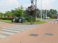
Questo anello è 100% corretto, corre in senso antiorario (quindi non troverai indicazioni lungo il percorso), e parte dai contenitori del vetro a Weerde (all'incrocio tra Galgenberg e Schumanlaan).
Buona fortuna a tutti.
See something wrong on this route?Add an issue
Navigate route in...
 RouteYou app Open
Don't want to see this ad anymore?
→ Upgrade now

Please wait, the navigation is being prepared.
You can now navigate. Have fun on the road!
Processing your request has failed. Please try again.
Don't want to see this ad anymore?
→ Upgrade now
Please wait, your download is being prepared.
Your download is ready. Have fun on the road!
Processing your request has failed. Please try again.
Don't want to see this ad anymore?
→ Upgrade now
Please wait, your print is being prepared.
Your print is ready to download. Have fun on the road!
Processing your request has failed. Please try again.
Additional feedback:
This feature is only available to RouteYou PREMIUM subscribers.
Try 1 month for free and discover the difference! We don't take any payment details, and your trial ends automatically after one month.
© 2006-2026 RouteYou - www.routeyou.com


 wy




 Start
 Download
 Download


