Link copied. Paste the link into Instagram to share the route.

Loop di Vlaanderen 2013-04-28: http://sport.be.msn.com/loopvanvlaanderen/2013/it/
Il punto di partenza e arrivo si trova nella Markt di Oudenaarde a 11m di altezza.
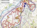
Questa routing GPS è stata creata sulla base della registrazione GPX esatta con il mio GPS e alcune piccole modifiche alle più recenti carte topografiche digitali NGI che mostrano i sentieri e i percorsi agricoli. Il sentiero non risulta essere lungo 50 km (ufficialmente) ma 51 km. E i metri di dislivello da superare per l'intero percorso sono 930 metri.
Tenendo conto delle differenze di altezza topografica NGI sommate (circa 930 metri), la distanza di corsa (reale inclinata) è di 51,18 km. Vedi anche il primo POI all'inizio (Markt Oudenaarde) per questi valori e un'immagine del profilo di altezza concreto in relazione al percorso da correre.
Il percorso consiste principalmente in strade asfaltate / pavimentate / tratti di ciottoli, con anche molti sentieri boschivi e agricoli. I tratti inclinati nell'ultima parte sono perlopiù non asfaltati. Il circuito di 51 km è quindi situato nel cuore delle Ardenne fiamminghe (con tutte le famose salite nel menu) ed è considerato in parte Trail.
Molti panorami eccezionalmente belli possono essere ammirati durante questo percorso.
Oltre il fiume Schelda a Oudenaarde si susseguono in ordine le seguenti salite fiamminghe (alcune vengono percorse lungo diversi fianchi; ogni freccia indica un dislivello lungo una valle di un corso d'acqua):
--> Achterberg, Ladueze,
--> Eikenberg,
--> Bossenare (parzialmente),
--> Koppenberg (1),
--> Onderbos,
--> Koppenberg (2),
--> Kwaremont (1),
--> Feelbos,
--> Kwaremont (2),
--> Paterberg (1),
--> Beiaard-Kalkoven lungo Paterberg (2),
--> Fonteinbos e Nophove,
--> (lungo Hoogberg),
--> Kabernol (Smisstraat),
--> Kortekeer (Nukerke),
--> Koppenberg (3).
Le Ardenne fiamminghe al suo meglio!
See something wrong on this route?Add an issue
Navigate route in...
 RouteYou app Open
Don't want to see this ad anymore?
→ Upgrade now

Please wait, the navigation is being prepared.
You can now navigate. Have fun on the road!
Processing your request has failed. Please try again.
Don't want to see this ad anymore?
→ Upgrade now
Please wait, your download is being prepared.
Your download is ready. Have fun on the road!
Processing your request has failed. Please try again.
Don't want to see this ad anymore?
→ Upgrade now
Please wait, your print is being prepared.
Your print is ready to download. Have fun on the road!
Processing your request has failed. Please try again.
Additional feedback:
This feature is only available to RouteYou PREMIUM subscribers.
Try 1 month for free and discover the difference! We don't take any payment details, and your trial ends automatically after one month.
© 2006-2026 RouteYou - www.routeyou.com


 wy




 Start
 Download
 Download


