Link copied. Paste the link into Instagram to share the route.

Sentiero Le Tombeau du Chevalier (58,76 km; D+ 2100m); versione sud Herbeumont.
Basato sugli ultimi dati del sentiero ‘in costruzione’ di http://www.festival-trail-semois.be/index.php, sulle carte topografiche NGI, sulla conoscenza personale della zona e su registrazioni GPX delle parti principali del percorso. Il sentiero reale non è in realtà questo, ma è diventato quello a nord.
Seguendo il Semois tra Les Mauleûx e La Roche du Chat, mi sono allontanato dal sentiero ‘in costruzione’ e ho seguito per un po’ il sentiero forestale lungo il Semois verso sud, dopo di che inizia la salita verso nord verso Rue des Épioux lungo un sentiero forestale.
La distanza piana è quindi di 57 km, la distanza reale che tiene conto delle variazioni di altitudine da percorrere è di 58,76 km; i metri di dislivello da superare sono 2100 m. Vedi il primo POI di questo anello (Dati topografici Le Tombeau du Chevalier) per la mappa dettagliata e i numeri.
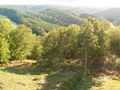
Questo sentiero è raccomandato per gli sportivi che amano trascorrere del tempo nel bosco e che sono pronti ad affrontare un dislivello di oltre 2000 m su più di 55 km.
See something wrong on this route?Add an issue
Navigate route in...
 RouteYou app Open
Don't want to see this ad anymore?
→ Upgrade now

Please wait, the navigation is being prepared.
You can now navigate. Have fun on the road!
Processing your request has failed. Please try again.
Don't want to see this ad anymore?
→ Upgrade now
Please wait, your download is being prepared.
Your download is ready. Have fun on the road!
Processing your request has failed. Please try again.
Don't want to see this ad anymore?
→ Upgrade now
Please wait, your print is being prepared.
Your print is ready to download. Have fun on the road!
Processing your request has failed. Please try again.
Additional feedback:
This feature is only available to RouteYou PREMIUM subscribers.
Try 1 month for free and discover the difference! We don't take any payment details, and your trial ends automatically after one month.
© 2006-2026 RouteYou - www.routeyou.com


 wy




 Start
 Download
 Download


