
Link copied. Paste the link into Instagram to share the route.

Thanks to our partner Tourist Board South Limburg (Visit Zuid-Limburg) you get free access to this route – and make your acquaintance with RouteYou PLUS.
Discover all benefits
Luoghi di partenza:
Il percorso Parkstad è composto da cinque anelli che sono collegati tra loro, in modo da poter percorrere ogni percorso separatamente, o i cinque anelli insieme. Le diramazioni sono segnalate da cartelli con i numeri dei percorsi.
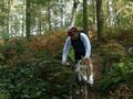
Questo percorso Parkstad Heerlen si trova tra il percorso Parkstad Landgraaf (Strijthagen) e il percorso di collegamento tra i percorsi Mechelen e Nuth-Voerendaal. Il percorso passa parzialmente attraverso boschi situati in quartieri residenziali, presenta un bel flowtrail nel bosco di Imstenrade e ha due lunghe salite e discese vicino al Kunderberg. Ci sono alcuni bellissimi panorami lungo il percorso. Le aree naturali di Imstenrade e Benzenrade rendono questo percorso più che meritevole.
Il percorso è segnato con pali di legno su cui è presente una targhetta gialla e in verde il segno internazionale per MTB.
Se hai commenti sul percorso, puoi informarli via routepunt@visitzuidlimburg.nl.
Una mappa completa dei percorsi MTB con 22 percorsi per mountain bike del Sud Limburgo (circa 500 km) è facile da ordinare tramite www.visitzuidlimburg.nl/webshop.
See something wrong on this route?Add an issue
Navigate route in...
 RouteYou app Open

Please wait, your print is being prepared.
Your print is ready to download. Have fun on the road!
Processing your request has failed. Please try again.
Additional feedback:
This feature is only available to RouteYou PREMIUM subscribers.
Try 1 month for free and discover the difference! We don't take any payment details, and your trial ends automatically after one month.
© 2006-2026 RouteYou - www.routeyou.com



 Tourist Board South Limburg (Visit Zuid-Limburg)






 Download


