Link copied. Paste the link into Instagram to share the route.

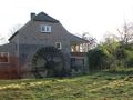
La passeggiata circolare inizia nel grazioso paesino di Geijsteren. Il percorso passa accanto al Geijsters Ven verso l'area naturale della Tenuta di Geijsteren. Seguendo un sentiero tortuoso lungo il Torrente Oostrumsche arriviamo al mulino ad acqua De Rosmolen. La passeggiata prosegue verso le Boshuizerbergen. Un bellissimo area naturale con dune di sabbia, angoli di sabbia mobile, licheni, pini silvestri e un grande arbusteto di ginepro.
Il percorso continua su sentieri boschivi fino alla cappella di San Willibrordus con un antico pozzo. La cappella risale al XVI secolo. Proseguendo, la passeggiata attraversa parti più basse e umide con prati paludosi. Resti di un antico meandro del Mosa.
Attraverso belle viali e un breve tratto di strada asfaltata si raggiunge il castello di Geijsteren. La rovina del castello risale al XIII secolo. Attraverso un portone c'è un sentiero verso il Mosa a circa 100 m più avanti. Da qui la passeggiata ritorna al villaggio di Geijsteren al punto di inizio/fine.
In sintesi, una splendida passeggiata variata nella natura in cui è possibile vedere anche molti uccelli e animali.
Punto di partenza/fine presso Dorpstraat 16 / Nieuwlandsestraat 1 a Geijsteren, ma può anche essere raggiunto dal parcheggio in Oostrumseweg 34 a Geijsteren.
See something wrong on this route?Add an issue
Navigate route in...
 RouteYou app Open
Don't want to see this ad anymore?
→ Upgrade now

Please wait, the navigation is being prepared.
You can now navigate. Have fun on the road!
Processing your request has failed. Please try again.
Don't want to see this ad anymore?
→ Upgrade now
Please wait, your download is being prepared.
Your download is ready. Have fun on the road!
Processing your request has failed. Please try again.
Don't want to see this ad anymore?
→ Upgrade now
Please wait, your print is being prepared.
Your print is ready to download. Have fun on the road!
Processing your request has failed. Please try again.
Additional feedback:
This feature is only available to RouteYou PREMIUM subscribers.
Try 1 month for free and discover the difference! We don't take any payment details, and your trial ends automatically after one month.
© 2006-2026 RouteYou - www.routeyou.com



 Jos Vos






 Start
Start Download
 Download

