Link copied. Paste the link into Instagram to share the route.

Aangename joggingpiste met aan de noordzijde voldoende parkeermogelijkheid.
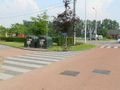
Exacte loopafstand is 1550m, bijna 1 mijl (1609m), gemeten met gecalibreerde fiets aan de binnenzijde van het pad (en kortste pad tussen bochten). Aan de zuidzijde moet je daarom wel het infobord en de vuilcontainer links laten als je in tegenuurwerkwijzerzin loopt; dus het heuveltje helemaal oplopen tot achter de bomen en de container, en niet de verkorting nemen.
Noord- en zuidoostelijk is er picknickmogelijkheid. Oostelijk is er een vogeluitkijkpost (volg daarvoor de staketsels). Vanuit de vier windrichtingen heb je een prachtig zicht op de visput.
Bij zeer nat weer durft het aan de noordelijke bocht wel eens glad te zijn.
Als je in tegenuurwerkwijzerszin de lus doet, dan is de (korte) zuidelijke looprichting voor het grootste deel bergop. de (langere) noordelijke looprichting heeft dan twee korte hellingen.
See something wrong on this route?Add an issue
Navigate route in...
 RouteYou app Open
Don't want to see this ad anymore?
→ Upgrade now

Please wait, the navigation is being prepared.
You can now navigate. Have fun on the road!
Processing your request has failed. Please try again.
Don't want to see this ad anymore?
→ Upgrade now
Please wait, your download is being prepared.
Your download is ready. Have fun on the road!
Processing your request has failed. Please try again.
Don't want to see this ad anymore?
→ Upgrade now
Please wait, your print is being prepared.
Your print is ready to download. Have fun on the road!
Processing your request has failed. Please try again.
Additional feedback:
This feature is only available to RouteYou PREMIUM subscribers.
Try 1 month for free and discover the difference! We don't take any payment details, and your trial ends automatically after one month.
© 2006-2026 RouteYou - www.routeyou.com


 wy




 Start
 Download
 Download


