Carlingford - Loop 1A- Commons Loop

Show mapNavigatePrintDownloadEdit
Advertisement
Advertisement
3.44 km
164 m
00h41
Medium

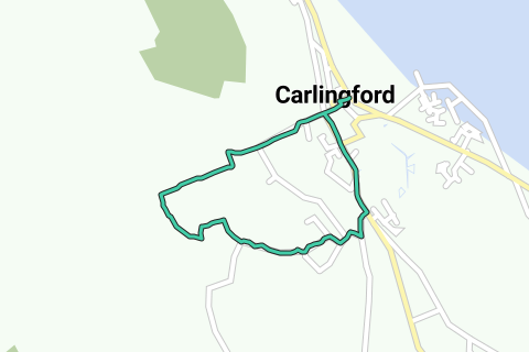
View on interactive map

Route information

267 views | Public

Last verified: 22 August 2024

Description by the author

More information on Openstreetmap.
Inspired by OSM.

Advertisement

Route origin

Route description

Region

Statistics

Difficulty level: Medium (67/100)

Length: 3.44 km

Duration: 00h41


Total ascent: 164 m

Maximal slope: 13.9 %

Average slope: 4.8 %

Net ascent: 0 m

Total descent: 164 m

Roads and subsoil

Paved roads: 2.15 km (63 %)

Cobblestones: 0 m (0 %)

Scenery

Car free roads: 1.07 km (31 %)

Noise pollution

Amount of traffic


Natural area

Urban area

Water rich area

Characteristics

    Themes

      Groups

        Start and end of the route

        Closest address to start and end: Market Street, R173, Louth, Ireland

        Navigate to starting point

        Places of interest

        1. Carlingford Abbey

          0 · Monument
          Carlingford Abbey, also called Carlingford Friary or Carlingford Priory, is a medieval Dominican …
          Wikipedia
        2. Carlingford

          0 · Village
          Carlingford is a coastal town and civil parish in northern County Louth, Ireland. For the …
          Wikipedia
        3. The Mint

          0 · Castle
          This castle, variously called a fortified house or tower house, derived its name from the license …
          Wikipedia
        4. King John's Castle

          0 · Monument
          King John's Castle, also known as Carlingford Castle, is an enclosure castle and National Monument …
          Wikipedia

        Interesting products for your trip

        Advertisement

        Comments

        Activities

        Nearby

        Routes nearby

        Lodging nearby

        Services nearby

        Carlingford Abbey
        Carlingford
        The Mint
        King John's Castle
        0 km0.2 km0.4 km0.6 km0.8 km1 km1.2 km1.4 km1.6 km1.8 km2 km2.2 km2.4 km2.6 km2.8 km3 km3.2 km3.4 km3.4 km3 m167 m
        PLUS
        50 m

        © 2006-2025 RouteYou - www.routeyou.com