
Link copied. Paste the link into Instagram to share the route.

Thanks to our partner Antwerpen Morgen you get free access to this route – and make your acquaintance with RouteYou PLUS.
Discover all benefits
Luogo di partenza
Ruige Heide, all'altezza del passaggio sotterraneo A12
Raggiungibile con:
Autobus 671, 770, 771, 772, 778, 779, 780
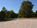
Paesaggio Questo paesaggio è strettamente legato alle sabbiose Kempen e ha un carattere molto più rurale rispetto all'altra area attorno ad Anversa. L'Heideland è isolato rispetto agli edifici. L'A12 forma una dura barriera che separa quest'area dal resto della città. Questo paesaggio è unico ad Anversa. Da nessuna parte all'interno della città l'habitat di heide e bosco è così intatto. La zona di Anversa si collega all'importante area transfrontaliera Natura2000 'Zoom-Kalmthoutse Heide', che comprende sia aree di direttiva sugli uccelli che aree di direttiva sugli habitat.
See something wrong on this route?Add an issue
Navigate route in...
 RouteYou app Open
Don't want to see this ad anymore?
→ Upgrade now

Please wait, the navigation is being prepared.
You can now navigate. Have fun on the road!
Processing your request has failed. Please try again.
Don't want to see this ad anymore?
→ Upgrade now
Please wait, your download is being prepared.
Your download is ready. Have fun on the road!
Processing your request has failed. Please try again.
Don't want to see this ad anymore?
→ Upgrade now
Please wait, your print is being prepared.
Your print is ready to download. Have fun on the road!
Processing your request has failed. Please try again.
Additional feedback:
This feature is only available to RouteYou PREMIUM subscribers.
Try 1 month for free and discover the difference! We don't take any payment details, and your trial ends automatically after one month.
© 2006-2026 RouteYou - www.routeyou.com


 Antwerpen Morgen




 Start
 Download
 Download


