Thanks to our partner Dromos, you can get free access to this route AND familiarize yourself with RouteYou PLUS.
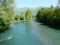
Discover all benefitsDer klassische Anstieg zum Hautacam von Argelès-Gazost. Beginnend in Argelès-Gazost (465 m) ist der Anstieg zum Hautacam (1560 m) 15,8 km lang. Über diese Distanz beträgt der Anstieg 1170 m (ein Durchschnitt von 6,8 %), mit einigen kurzen Abschnitten von 10 %. Das Ziel der Tour de France 2008 befindet sich in einer Höhe von 1520 m.
See something wrong on this route?Add an issue
Navigate route in...
![]() RouteYou app Open
RouteYou app Open
Don't want to see this ad anymore?
→ Upgrade now
![]()
Please wait, the navigation is being prepared.
You can now navigate. Have fun on the road!
Processing your request has failed. Please try again.
Don't want to see this ad anymore?
→ Upgrade now
![]()
Please wait, your download is being prepared.
Your download is ready. Have fun on the road!
Processing your request has failed. Please try again.
Don't want to see this ad anymore?
→ Upgrade now
![]()
Please wait, your print is being prepared.
Your print is ready to download. Have fun on the road!
Processing your request has failed. Please try again.
<iframe src="https://plugin.routeyou.com/routeviewer/free/?language=en&params.route.id=1189832&params.language=de" width="100%" height="600" frameborder="0" allowfullscreen></iframe>
<p><a class="routeYou_embed" href="https://app.routeyou.com/de-fr/route/view/1189832?utm_source=embed&utm_medium=article&utm_campaign=routeshare&navigation=external" title="Besteigung des Hautacam - RouteYou" target="_blank"><img src="https://image.routeyou.com/embed/route/960x670/1189832-de@2x.png" style="width: 100%; height: auto;" alt="Besteigung des Hautacam"></a></p>
Additional feedback:
This feature is only available to RouteYou PREMIUM subscribers.
Try 1 month for free and discover the difference! We don't take any payment details, and your trial ends automatically after one month.
© 2006-2026 RouteYou - www.routeyou.com