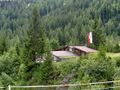
Rocoso y escarpado, el mundo montañoso se presenta al pie del Muttekopf, que se eleva a 2.774 metros. Dado que en esta caminata de Hoch-Imst por el Drischlsteig hasta la cabaña Muttekopf y la cabaña Latschen casi todo es cuesta abajo, el majestuoso panorama se puede disfrutar sin mucho esfuerzo. Solo en el expuesto, pero bien asegurado Drischlsteig se requiere algo de concentración en algunos tramos. Después de un alto en una de las cabañas, que ofrecen ambas una excelente comida, aún queda lo mejor en la Alm Untermarkter: un paseo en el Alpine Coaster de 3,5 kilómetros, una de las más largas de su tipo en los Alpes. Alternativamente, se puede finalizar la ruta a pie.
La ruta comienza en Hoch-Imst con un viaje en telesilla hasta Alpjoch a más de 2.000 metros de altura. Allí comienza la verdadera caminata. Primero se desciende suavemente por el expuesto, pero bien asegurado Drischlsteig hasta la cabaña Muttekopfhütte, donde se puede hacer una pausa. Luego, se continúa por el sendero hacia la "Latschenhütte" y se baja por la ladera de prados con rocas frente a la cabaña. Pronto se cruza un arroyo y se llega a una bifurcación del camino; aquí no continuar por el "Plattigsteig", sino ir a la derecha por el sendero marcado, pero sin señalizar. Poco después se cruza otro arroyo, y el recorrido finalmente lleva a la estación inferior del teleférico de material. Ahora se avanza por el camino a la izquierda del arroyo, suavemente saliendo del fondo del valle cerrado por la montaña Muttekopf de Imst hacia la original cabaña Latschenhütte. Allí, al lado de la terraza en "Jägersteig", se cruza el arroyo y se desciende cómodamente por el claro bosque (en el tipo de sendero), hasta que el sendero desemboca en un amplio camino peatonal cerca de un puente; en ese lugar, se sigue en la misma dirección hacia la pista de esquí. Se sigue el camino en la pista hacia abajo hasta la Alm Untermarkter en la estación del telesilla, donde se encuentra el punto de partida del Alpine Coaster, una montaña rusa alpina de 3,5 kilómetros. Ahora hay dos opciones: o se continúa caminando por la carretera forestal hacia abajo a Hoch-Imst (siempre orientándose por las farolas). O, en su lugar, se puede disfrutar de un paseo en uno de los veloces trineos, que también termina en Hoch-Imst.
See something wrong on this route?Add an issue
Navigate route in...
![]() RouteYou app Open
RouteYou app Open
Don't want to see this ad anymore?
→ Upgrade now
![]()
Please wait, the navigation is being prepared.
You can now navigate. Have fun on the road!
Processing your request has failed. Please try again.
Don't want to see this ad anymore?
→ Upgrade now
![]()
Please wait, your download is being prepared.
Your download is ready. Have fun on the road!
Processing your request has failed. Please try again.
Don't want to see this ad anymore?
→ Upgrade now
![]()
Please wait, your print is being prepared.
Your print is ready to download. Have fun on the road!
Processing your request has failed. Please try again.
<iframe src="https://plugin.routeyou.com/routeviewer/free/?language=en&params.route.id=15259246&params.language=es" width="100%" height="600" frameborder="0" allowfullscreen></iframe>
<p><a class="routeYou_embed" href="https://app.routeyou.com/es-at/route/view/15259246?utm_source=embed&utm_medium=article&utm_campaign=routeshare&navigation=external" title="Drischlsteig - Muttekopfhütte - Latschenhütte - RouteYou" target="_blank"><img src="https://image.routeyou.com/embed/route/960x670/15259246-es@2x.png" style="width: 100%; height: auto;" alt="Drischlsteig - Muttekopfhütte - Latschenhütte"></a></p>
Additional feedback:
This feature is only available to RouteYou PREMIUM subscribers.
Try 1 month for free and discover the difference! We don't take any payment details, and your trial ends automatically after one month.
© 2006-2026 RouteYou - www.routeyou.com