Link copied. Paste the link into Instagram to share the route.

Esta ruta/circuito de MTB transcurre íntegramente por el lado oeste de la E19 en Zemst y pasa cerca de Vilvoorde.
Es un circuito de aproximadamente 25 km, diseñado para ciclistas de montaña, ubicado en Zemst y una parte en Vilvoorde (en y alrededor de Houtem).
En el sitio de MTB también se menciona este circuito (https://www.routeyou.com/nl/route/view/680525/mountainbikeroute/mtb-zemst-groene-lus.nl), pero en esta ruta también hay varios errores. Estos se han comunicado, pero tanto en los letreros en los puntos de inicio (por ejemplo, aquí: Letrero informativo que está en Houtem (Vilvoorde): https://www.routeyou.com/nl/location/view/47929192/informatiebord-mtb-lus-zemst-te-houtem-hier-komt-de-groene-lus-langs.nl) como en la ruta GPX, estos errores siguen presentes. Así que no los utilices y toma este correcto aquí.
Para los corredores de trail, algunas características del circuito:
Distancia real de carrera = 25,2 km
distancia asfaltada = 16,8 km (=67%)
distancia pavimentada (dolomita etc.) = 4,1 km (=16%)
distancia no pavimentada = 4,3 km (=17%)
Durante algo menos de 3 km hay posibilidad de desviarse de la pista asfaltada y tomar un camino sin pavimentar.
Bastante asfalto y terreno pavimentado, puedes correr fácilmente este circuito con zapatillas de correr normales.
El circuito en el letrero informativo sigue en sentido horario y está marcado en esa dirección con señalización verde.
El circuito dibujado en el letrero informativo es incorrecto en varios lugares (tramos intransitables en Eppegem y Weerde). Si sigues las flechas verdes en 'sentido horario', y no han desaparecido (lo que ha ocurrido varias veces), entonces no necesitas este mapa.
En el sitio de Rutas de Mountainbike (http://www.mtbroutes.be/routedetail.php?id=221) hay los mismos errores en el GPX de este circuito.
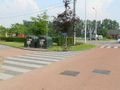
Este circuito es 100% correcto, transcurre en sentido antihorario (así que no encontrarás indicaciones en el camino), y comienza en los contenedores de vidrio en Weerde (en la intersección de Galgenberg con Schumanlaan).
Suerte a todos.
See something wrong on this route?Add an issue
Navigate route in...
 RouteYou app Open
Don't want to see this ad anymore?
→ Upgrade now

Please wait, the navigation is being prepared.
You can now navigate. Have fun on the road!
Processing your request has failed. Please try again.
Don't want to see this ad anymore?
→ Upgrade now
Please wait, your download is being prepared.
Your download is ready. Have fun on the road!
Processing your request has failed. Please try again.
Don't want to see this ad anymore?
→ Upgrade now
Please wait, your print is being prepared.
Your print is ready to download. Have fun on the road!
Processing your request has failed. Please try again.
Additional feedback:
This feature is only available to RouteYou PREMIUM subscribers.
Try 1 month for free and discover the difference! We don't take any payment details, and your trial ends automatically after one month.
© 2006-2026 RouteYou - www.routeyou.com


 wy




 Start
 Download
 Download


