
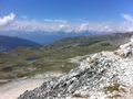
Disfruta de la vista a 3000m de altura y camina a través de la pura naturaleza inexplorada sobre el Val d'Anniviers
Resumen:
Esta caminata te lleva lejos de la civilización, la pura naturaleza en su mejor momento. Después de escalar dos cumbres, Rothorn y Bella Tolla, descendemos hacia el pas de Boeuf en el amplio desierto rocoso. Regresamos del Meidpass nuevamente a la civilización hacia el punto de partida: Chandolin.
Consejos:
Para esta caminata tendrás que tener un poco más de experiencia.
Hay dos partes difíciles en esta caminata. La primera es descender por una cuerda en la Bella Tolla. La segunda es el campo de escombros después del Pas de Boeuf donde debes seguir los restos de pintura, montones de piedras, el mapa topográfico y la guía GPS.
Debido a la altitud de esta caminata, el clima debe ser bueno con poca nieve por debajo de 3000m. Cuando el nivel de congelación está a 4000m y hace un clima cálido agradable, eso es ideal.
Cumbres montañosas:
Rothorn (Phare de Griolet) 2998m
Bella Tolla 3024m
Punto de partida:
Chandolin, centro del pueblo en el Val d'Anniviers
Direcciones:
- Cabane de la Bella Tolla
- Bella Tolla - Rothorn
- Pas de Boeuf
- sin ruta - pintura
- Meidpass
- Chalet Blanc
- Tignousa
- Chandolin
See something wrong on this route?Add an issue
Navigate route in...
 RouteYou app Open
Don't want to see this ad anymore?
→ Upgrade now

Please wait, the navigation is being prepared.
You can now navigate. Have fun on the road!
Processing your request has failed. Please try again.
Don't want to see this ad anymore?
→ Upgrade now
Please wait, your download is being prepared.
Your download is ready. Have fun on the road!
Processing your request has failed. Please try again.
Don't want to see this ad anymore?
→ Upgrade now
Please wait, your print is being prepared.
Your print is ready to download. Have fun on the road!
Processing your request has failed. Please try again.
<iframe src="https://plugin.routeyou.com/routeviewer/free/?language=en&params.route.id=2260654&params.language=es" width="100%" height="600" frameborder="0" allowfullscreen></iframe>
<p><a class="routeYou_embed" href="https://app.routeyou.com/es-ch/route/view/2260654?utm_source=embed&utm_medium=article&utm_campaign=routeshare&navigation=external" title="Bella Tolla (3024 m), Rothorn (2998 m) al Meidpass y de vuelta - RouteYou" target="_blank"><img src="https://image.routeyou.com/embed/route/960x670/2260654-es@2x.png" style="width: 100%; height: auto;" alt="Bella Tolla (3024 m), Rothorn (2998 m) al Meidpass y de vuelta"></a></p>
Additional feedback:
This feature is only available to RouteYou PREMIUM subscribers.
Try 1 month for free and discover the difference! We don't take any payment details, and your trial ends automatically after one month.
© 2006-2026 RouteYou - www.routeyou.com



 Sander Vancanneyt






 Start
Start Download
 Download

