Link copied. Paste the link into Instagram to share the route.

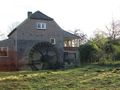
La ruta circular comienza en el bonito pueblo de Geijsteren. El recorrido pasa por el Geijsters Ven hacia la zona natural de la finca Geijsteren. A lo largo de un sendero serpenteante junto al arroyo Oostrumsche Beek, llegamos al molino de agua De Rosmolen. Más adelante, la caminata nos lleva a las Boshuizerbergen. Una hermosa zona natural con dunas de arena, rincones de arena movida, líquenes, pinos de bosque y un gran arbusto de enebro.
El recorrido continúa por senderos forestales hacia la capilla de San Willibrordus, que cuenta con un antiguo pozo. La capilla data del siglo XVI. Más adelante, la caminata transcurre por partes más bajas y húmedas con prados pantanosos. Restos de una antigua meandro del Mosa.
A través de bellos caminos y un pequeño tramo de camino pavimentado, se alcanza el castillo de Geijsteren. La ruina del castillo data del siglo XIII. A través de una puerta hay un sendero que lleva al Mosa, a unos 100 m más adelante. Desde aquí, la caminata regresa al pueblo de Geijsteren al punto de inicio/final.
En resumen, una hermosa y variada caminata por la naturaleza en la que también puedes ver muchas aves y animales.
Punto de inicio/final en Dorpstraat 16 / Nieuwlandsestraat 1 en Geijsteren, pero también se puede acceder desde el aparcamiento en Oostrumseweg 34 en Geijsteren.
See something wrong on this route?Add an issue
Navigate route in...
 RouteYou app Open
Don't want to see this ad anymore?
→ Upgrade now

Please wait, the navigation is being prepared.
You can now navigate. Have fun on the road!
Processing your request has failed. Please try again.
Don't want to see this ad anymore?
→ Upgrade now
Please wait, your download is being prepared.
Your download is ready. Have fun on the road!
Processing your request has failed. Please try again.
Don't want to see this ad anymore?
→ Upgrade now
Please wait, your print is being prepared.
Your print is ready to download. Have fun on the road!
Processing your request has failed. Please try again.
Additional feedback:
This feature is only available to RouteYou PREMIUM subscribers.
Try 1 month for free and discover the difference! We don't take any payment details, and your trial ends automatically after one month.
© 2006-2026 RouteYou - www.routeyou.com



 Jos Vos






 Start
Start Download
 Download

