
Link copied. Paste the link into Instagram to share the route.

Questa è la versione grande di "The19DemarcationsStones". In questa versione è previsto anche un ritorno a Nieuwpoort, scelto in modo tale che si possa procedere velocemente per percorrere la distanza totale in un giorno.
Questo percorso collega i 19 restanti segnalini di demarcazione in Belgio. Poiché questi segnalini costituiscono il tema principale del percorso che di per sé è già piuttosto lungo, ho scelto di non fare deviazioni extra per visitare altre attrazioni (a volte molto interessanti).
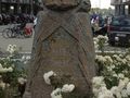
Questi segnalini di demarcazione sono pietre commemorative che indicano approssimativamente fino a dove si estendeva il fronte occidentale tedesco durante la Prima Guerra Mondiale. Sono pietre di granito rosa alte 1,25 metri. In cima è rappresentato un elmo da soldato, appoggiato su una corona di alloro con il nome del settore del fronte. Sugli angoli ci sono rappresentati un proiettile, a sinistra una borraccia e a destra una maschera antigas.
In Belgio ci sono tre varianti. Il tipo belga ha un elmo adrian belga con una testa di leone, il tipo francese un elmo adrian francese con l'iscrizione RF e il tipo britannico un elmo brodie britannico.
Se le iscrizioni sono state conservate, si può leggere il seguente testo (in 3 lingue):
"Qui il conquistatore fu fermato - Ici fut arrêté l'envahisseur - Here the invader was brought to a standstill".
Il percorso parte da Nieuwpoort e termina a Loker, vicino al confine francese. Approssimativamente si percorre quindi il fronte della Prima Guerra Mondiale.
See something wrong on this route?Add an issue
Navigate route in...
 RouteYou app Open
Don't want to see this ad anymore?
→ Upgrade now

Please wait, the navigation is being prepared.
You can now navigate. Have fun on the road!
Processing your request has failed. Please try again.
Don't want to see this ad anymore?
→ Upgrade now
Please wait, your download is being prepared.
Your download is ready. Have fun on the road!
Processing your request has failed. Please try again.
Don't want to see this ad anymore?
→ Upgrade now
Please wait, your print is being prepared.
Your print is ready to download. Have fun on the road!
Processing your request has failed. Please try again.
Additional feedback:
This feature is only available to RouteYou PREMIUM subscribers.
Try 1 month for free and discover the difference! We don't take any payment details, and your trial ends automatically after one month.
© 2006-2026 RouteYou - www.routeyou.com



 MarcMonballieu






 Start
Start Download
 Download

