Link copied. Paste the link into Instagram to share the route.

Pista di jogging piacevole con ampie possibilità di parcheggio sul lato nord.
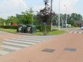
La distanza esatta è di 1550m, quasi 1 miglio (1609m), misurata con una bicicletta calibrata all'interno del sentiero (e il percorso più breve tra le curve). Sul lato sud, devi quindi tenere il pannello informativo e il contenitore della spazzatura a sinistra se segui il senso antiorario; quindi, devi salire completamente la collinetta fino dietro gli alberi e il contenitore, e non prendere il percorso abbreviato.
A nord e a sud-est ci sono possibilità di pic-nic. A est c'è un punto di osservazione per gli uccelli (segui le strutture di legno). Da tutte e quattro le direzioni hai una vista splendida sul bacino di pesca.
In caso di tempo molto umido, la curva nord può essere scivolosa.
Se segui il percorso in senso antiorario, la direzione di camminata (breve) a sud è per la maggior parte in salita. La direzione di camminata (più lunga) a nord ha invece due piccole pendenze.
See something wrong on this route?Add an issue
Navigate route in...
 RouteYou app Open
Don't want to see this ad anymore?
→ Upgrade now

Please wait, the navigation is being prepared.
You can now navigate. Have fun on the road!
Processing your request has failed. Please try again.
Don't want to see this ad anymore?
→ Upgrade now
Please wait, your download is being prepared.
Your download is ready. Have fun on the road!
Processing your request has failed. Please try again.
Don't want to see this ad anymore?
→ Upgrade now
Please wait, your print is being prepared.
Your print is ready to download. Have fun on the road!
Processing your request has failed. Please try again.
Additional feedback:
This feature is only available to RouteYou PREMIUM subscribers.
Try 1 month for free and discover the difference! We don't take any payment details, and your trial ends automatically after one month.
© 2006-2026 RouteYou - www.routeyou.com


 wy




 Start
 Download
 Download


