Link copied. Paste the link into Instagram to share the route.

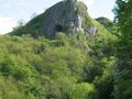
Il Manifold Trail segue il percorso della dismessa Leek and Manifold Light Railway, attraverso le valli di Manifold e Hamps. Il tracciato è asfaltato e abbastanza pianeggiante per tutta la sua lunghezza, rendendolo ideale per utenti in sedia a rotelle, persone con passeggini o carrozzine e persone con mobilità ridotta. Fai attenzione ai fiumi di Manifold e Hamps mentre scompaiono sotto il calcare poroso e riappaiono nel Parco Nazionale di Ilam. Salendo i gradini fino alla Grotta di Thor (250 piedi sopra il tracciato) potrai godere di magnifiche vedute sulla valle. Ci sono aree di parcheggio auto a entrambe le estremità del tracciato e in luoghi intermedi.
See something wrong on this route?Add an issue
Navigate route in...
 RouteYou app Open
Don't want to see this ad anymore?
→ Upgrade now

Please wait, the navigation is being prepared.
You can now navigate. Have fun on the road!
Processing your request has failed. Please try again.
Don't want to see this ad anymore?
→ Upgrade now
Please wait, your download is being prepared.
Your download is ready. Have fun on the road!
Processing your request has failed. Please try again.
Don't want to see this ad anymore?
→ Upgrade now
Please wait, your print is being prepared.
Your print is ready to download. Have fun on the road!
Processing your request has failed. Please try again.
Additional feedback:
This feature is only available to RouteYou PREMIUM subscribers.
Try 1 month for free and discover the difference! We don't take any payment details, and your trial ends automatically after one month.
© 2006-2026 RouteYou - www.routeyou.com



 Wingreen






 Start
Start Download
 Download

