Link copied. Paste the link into Instagram to share the route.

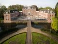
Il Percorso dei Castelli si snoda attraverso una parte bellissima e storica del Parco Nazionale dell'Utrechtse Heuvelrug.
Il Parco Nazionale è un'area per lo più collinare di circa 6000 ha (60 km²). Comprende fino ad oggi la parte sud-orientale dell'Utrechtse Heuvelrug ed è composta da boschi, brughiere, dune di sabbia e prati. Sul lato sud si trovano le zone di inondazione del Reno inferiore. Il confine settentrionale è rappresentato dall'A12. A nord, l'Utrechtse Heuvelrug si trasforma in Het Gooi. Il confine tra l'Heuvelrug e Het Gooi è la Laagte di Pijnenburg.
Grazie ai boschi e ai manieri, l'heuvelrug era diventato, a partire dal 17° secolo, un ambiente attraente per i cittadini provenienti dall'ovest. L'accessibilità aumentò nel 1815 con la pavimentazione della strada da De Bilt a Rhenen. Da quel momento si osserva un forte aumento del numero di residenze estive; nell'area del Parco Nazionale ci sono ancora circa 80 luoghi riconoscibili come residenze estive.
In particolare, alla fine del 18° secolo, molti ricchi olandesi si stabilirono in questa parte dell'Utrechtse Heuvelrug, creando splendide residenze estive, dove generalmente trascorrevano alcuni mesi all'anno. Attorno ai castelli, alle ville e alle residenze si tendeva a progettare giardini e parchi, nei quali possiamo osservare uno sviluppo di diversi stili. La maggior parte di queste residenze estive si trova lungo l'attuale N225. Oggi molte residenze estive sono di proprietà di aziende, che vi hanno stabilito i loro uffici. Alcune sono cadute in rovina e sono state persino demolite.
Sin dall'inizio del 19° secolo, questa parte dell'Utrechtse Heuvelrug è conosciuta come "La Lustwarande di Sticht".
See something wrong on this route?Add an issue
Navigate route in...
 RouteYou app Open
Don't want to see this ad anymore?
→ Upgrade now

Please wait, the navigation is being prepared.
You can now navigate. Have fun on the road!
Processing your request has failed. Please try again.
Don't want to see this ad anymore?
→ Upgrade now
Please wait, your download is being prepared.
Your download is ready. Have fun on the road!
Processing your request has failed. Please try again.
Don't want to see this ad anymore?
→ Upgrade now
Please wait, your print is being prepared.
Your print is ready to download. Have fun on the road!
Processing your request has failed. Please try again.
Additional feedback:
This feature is only available to RouteYou PREMIUM subscribers.
Try 1 month for free and discover the difference! We don't take any payment details, and your trial ends automatically after one month.
© 2006-2026 RouteYou - www.routeyou.com



 MX-5 Roadster Club NL






 Start
Start Download
 Download

