Grazie al nostro partner Pasar vzw, puoi accedere gratuitamente a questo itinerario e conoscere RouteYou PLUS.
Scopri tutti i vantaggi Azure
AzureAppointment at the Theodardusplein (V) in Beringen-Mijn. You will find this square, with ample parking, along the N72 right in front of the Sint-Theodardus church, a modern church (1939-1943) with a large rectangular atrium like a medieval cloister. You can also get there by public transport via bus line 29 Leopoldsburg-Hasselt.
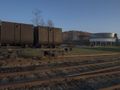
Walk on the Theodardusplein into the beautiful lindendreef. At the end cross the stone road, turn left and after 100 m right into the Ulfortstraat. Cross an old railway bed. To the right behind the greenery is the cemetery of Beverlo. The surroundings are immediately amazingly quiet and green. At the end of the cemetery, turn left into the forest on a narrow forest path. You walk here in a beautiful forest of Scots pine with a lot of mountain ash in the undergrowth. Also look out for honeysuckle and Judas ear. At a crossroads of forest paths you go straight ahead and a little further you connect to another path that comes from the left and another 100 m further you turn left at a fork and continue to walk in the forest at the bottom of a high slope. Ignore all the side roads that go up the embankment to the left and keep the embankment on the left above you. Eventually you walk straight out of the forest under a high-voltage pylon. Cross the main road and turn right. Ignore the forest road on the left, cross the Olmsesteenweg 350 m further and walk into the Lossingstraat. The landscape remains calm, green and very inviting. Continue straight on to the Albert Canal and then to the right on the towpath. The Albert Canal was planned in the twenties of the last century, dug in the thirties, officially inaugurated on 30 July 1939, but only put into use in 1946 due to the Second World War. It connects Antwerp with Liège and is important not only for transport and the numerous industrial complexes along its banks, but also for the drinking water supply of the Antwerp region, which depends on the Meuse water supplied via the canal. On the other side of the canal, divided between the municipalities of Beringen, Tessenderlo and Ham, lies the industrial area Ravenshout 1, the second largest in Limburg. After 900 m you walk to the right at a blue sign 'Fietspad Limburgse Kempen 339', away from the canal, on a path between the vegetation. The path soon widens. Always stay straight on this green road and ignore the narrow dirt road (probably worn out by mountain bikes) that constantly curves on the right and then comes back next to the wider, overgrown road. After 300 m, look out for a narrow road that runs perpendicular to the left between the denser vegetation. Walk into the path and after about ten meters over a canal and another 10 m further to the right. The forest path will soon widen and will take you to a T-junction via a few bends after 400 m. Turn left on the even wider forest road. After 200 m you cross the stone road and walk straight between concrete tubs on another forest road. Continue straight until you reach the next stone road. Here to the left and after 150 m turn right into an earth road. Enjoy the beautiful green décor. Ignore all side roads and always walk straight ahead. After more than 1 km, at a fork (left signs of Bosbeheer) turn left and 100 m further do not turn left at right angles, but diagonally left. At a crossroads of forest roads straight ahead and you will soon be walking next to the concrete fences of backyards. After 300 m, ignore a turn right and continue next to the backyards. At a T-junction, turn right on the gravel road. Just turn right on the wide asphalt road and then left into the Wystekkenstraat. Ignore all side streets and walk straight ahead towards the church tower. Cross another stone road, continue straight into the Twaalfmeilaan and finally turn right along the busy N72 back to Theodardusplein.
A visit to the Flemish mining museum 2 a few hundred meters away is highly recommended
Hai notato qualcosa su questo itinerario?Aggiungere un problema
Naviga nel percorso in...
![]() App RouteYou Aprire
App RouteYou Aprire
![]()
Attendi, la tua stampa è in preparazione.
La tua stampa è pronta per il download. Buon divertimento in viaggio!
Elaborazione della richiesta non è riuscita. Si prega di riprovare.
<iframe src="https://plugin.routeyou.com/routeviewer/free/?language=it&params.route.id=5367076&params.language=en" width="100%" height="600" frameborder="0" allowfullscreen></iframe>
<p><a class="routeYou_embed" href="https://app.routeyou.com/en-be/route/view/5367076?utm_source=embed&utm_medium=article&utm_campaign=routeshare&navigation=external" title="Along the Albert Canal in Beverlo - RouteYou" target="_blank"><img src="https://image.routeyou.com/embed/route/960x670/5367076-en@2x.png" style="width: 100%; height: auto;" alt="Along the Albert Canal in Beverlo"></a></p>
Altri commenti:
Questa funzionalità è disponibile esclusivamente per gli abbonati a RouteYou PREMIUM.
Prova 1 mese gratis e scopri la differenza! Non prendiamo alcun dettaglio di pagamento e la tua prova termina automaticamente dopo un mese.
© 2006-2026 RouteYou - www.routeyou.com