Oberwald - Obergesteln - Ulrichen - Geschinen - Münster - Reckingen - Gluringen - Ritzingen - Biel - Selkingen - Blitzingen - Niederwald - Bellwald
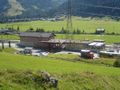
The Goms high route lies between Oberwald and Bellwald along the sunny slope of the Goms. It leads through a fascinating landscape of meadows and forests and offers spectacular views of numerous 4000m peaks. The trail is well maintained and accessible from all the Upper Goms villages thanks to the Matterhorn Gotthard railway which has a stop in each village. There are a number of variations on this tour.
Source: Valais Wallis Promotion
Navigate route in...
![]() RouteYou app Open
RouteYou app Open
Don't want to see this ad anymore?
→ Upgrade now
![]()
Please wait, the navigation is being prepared.
You can now navigate. Have fun on the road!
Processing your request has failed. Please try again.
Don't want to see this ad anymore?
→ Upgrade now
![]()
Please wait, your download is being prepared.
Your download is ready. Have fun on the road!
Processing your request has failed. Please try again.
Don't want to see this ad anymore?
→ Upgrade now
![]()
Please wait, your print is being prepared.
Your print is ready to download. Have fun on the road!
Processing your request has failed. Please try again.
Don't want to see this ad anymore?
→ Upgrade now
![]()
Please wait, your download is being prepared.
Your download is ready. Have fun on the road!
Processing your request has failed. Please try again.
<iframe src="https://plugin.routeyou.com/routeviewer/free/?language=en&params.route.id=5314991" width="100%" height="600" frameborder="0" allowfullscreen></iframe>
<a href="https://www.routeyou.com/en-ch/route/view/5314991/hiking-route/goms-high-route?utm_source=embed&utm_medium=article&utm_campaign=routeshare" title="Goms high route - RouteYou" target="_blank"><img src="https://image.routeyou.com/embed/route/960x670/5314991-en@2x.png" width="960" height="670" alt="Goms high route"></a>
Additional feedback:
Try this feature for free with a RouteYou Plus trial subscription.
If you already have such an account, then log in now.
Try this feature for free with a RouteYou Premium trial subscription.
© 2006-2024 RouteYou - www.routeyou.com