Stratfield Mortimer is a village and civil parish, just south of Reading, in the English ceremonial county of Berkshire and district of West Berkshire.
The south and south-east half of the parish consists of farms with a small percentage of woodland and is bisected towards the middle of the whole area by the Foudry Brook and adjacent Reading to Basingstoke Line which is more than 40% on raised embankments but in the far south is in a cutting. The north-east of the parish is the most populated: and is not so semi-rural or rural in density; it is the part more often colloquially called Mortimer. This more outlet- and amenity-served part, traditionally known as Mortimer Common, is at the top of the hill in Stratfield Mortimer civil parish. The northwestern 5% of the land is Mortimer Woods or common land which blends into Wokefield Common - Mortimer Woods has a set of Scheduled Ancient Monuments – one large, steep Bronze Age round barrow and three further smaller bowl barrows.
Font: Wikipedia.org
Drets d'autor: Creative Commons 3.0
![]() | | Pública | Italià • Neerlandès
| | Pública | Italià • Neerlandès
Stratfield Mortimer, West Berkshire, Regne Unit
Descobriu les rutes més boniques i conegudes de la zona, acuradament agrupades en seleccions adequades.
Font: Graham Horn
Drets d'autor: Creative Commons 2.0
Descobriu els llocs d'interès més bonics i coneguts de la zona, acuradament agrupats en seleccions adequades.
Font: Graham Horn
Drets d'autor: Creative Commons 2.0
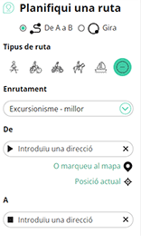
Amb RouteYou pots crear mapes personalitzats molt fàcilment. Defineix la teva ruta, afegeix waypoints o interseccions, planifica parades a punts d'interès o a establiments per menjar i beure i comparteix-ho tot amb els amics i la família.
Planificador de rutes

<iframe src="https://plugin.routeyou.com/poiviewer/free/?language=ca&params.poi.id=1532061&params.language=en" width="100%" height="600" frameborder="0" allowfullscreen></iframe>
Proveu aquesta funcionalitat gratuïtament amb una subscripció de prova RouteYou Plus.
Si ja disposa d'aquest compte, connecteu ara.
© 2006-2024 RouteYou - www.routeyou.com