Old John is the highest hill in Bradgate Park, Leicestershire, England, on the southern edge of Charnwood Forest. It gives its name to the folly that stands at its top. The hill stands at 212 metres high, and is a prominent landmark across Leicester and Leicestershire.
The earliest recorded use of the name is on a map of 1754, which records a windmill on the site, some 30 years before the tower was built. The tower itself began life as a ruined folly, built in 1784, during the time of George Grey, 5th Earl of Stamford. He got Thomas Sketchley of Anstey to build him the mock ruin, which had strong similarities to Mow Cop, Staffordshire. It was adapted in the mid-19th century by the seventh Earl to serve as an observation tower for the practice circuit he laid out for his horses, along with the building of a stable block lower down the hill. It is well known for its "mug-shape" — there was a longer section of wall adjoining the tower after the 19th century extension but this reduced in size over the years leaving the present 'handle' shape. The mug shape has given rise to false accounts of the tower's origins supposedly relating to a beer-loving miller who was killed after being hit by a pole during a bonfire.
Font: Wikipedia.org
Drets d'autor: Creative Commons 3.0
![]() | | Pública
| | Pública
Charnwood, Regne Unit
Descobriu les rutes més boniques i conegudes de la zona, acuradament agrupades en seleccions adequades.
Font: Duncharris
Drets d'autor: Creative Commons 3.0
Descobriu els llocs d'interès més bonics i coneguts de la zona, acuradament agrupats en seleccions adequades.
Font: Duncharris
Drets d'autor: Creative Commons 3.0
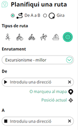
Amb RouteYou pots crear mapes personalitzats molt fàcilment. Defineix la teva ruta, afegeix waypoints o interseccions, planifica parades a punts d'interès o a establiments per menjar i beure i comparteix-ho tot amb els amics i la família.
Planificador de rutes

<iframe src="https://plugin.routeyou.com/poiviewer/free/?language=ca&params.poi.id=1531256&params.language=en" width="100%" height="600" frameborder="0" allowfullscreen></iframe>
Proveu aquesta funcionalitat gratuïtament amb una subscripció de prova RouteYou Plus.
Si ja disposa d'aquest compte, connecteu ara.
© 2006-2024 RouteYou - www.routeyou.com