Slow Paths Hiking Network - Wachtebeke
Circular hike: The Red Moer Path
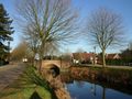
Start and endpoint: Balkenbrug Langelede, Junction 4
The first section of the route between Junction 3 and the N49 runs through an agricultural area known as 'Red Moer'. In fact, the fertile soils have a rusty color, indicating a high iron content in the soil. In the last section, along the parallel road to the N49, you will find the designation "Betje" for the lands. In the 17th century, there was the farm of "Elisabeth Everdy" there, hence the name "Betje". The farm has long since disappeared, but on a meadow, one still notices a rise that could indicate the remains of this farm.
Route:
From Jcn --> to Jcn: Distance in km
4 --> 3: 0.4
3 --> 21: 2.0
21 --> 20: 0.7
20 --> 7: 2.1
7-6 --> 4: 0.8
A map of the hiking network is available at the 'Cultural House Safarken' (Dr. J. Persynplein 6, Wachtebeke).
More information?
Report missing or damaged signposts?
--> TrageWegenWachtebeke@gmail.com
See something wrong on this route?Add an issue
Navigate route in...
![]() RouteYou app Open
RouteYou app Open
Don't want to see this ad anymore?
→ Upgrade now
![]()
Please wait, the navigation is being prepared.
You can now navigate. Have fun on the road!
Processing your request has failed. Please try again.
Don't want to see this ad anymore?
→ Upgrade now
![]()
Please wait, your download is being prepared.
Your download is ready. Have fun on the road!
Processing your request has failed. Please try again.
Don't want to see this ad anymore?
→ Upgrade now
![]()
Please wait, your print is being prepared.
Your print is ready to download. Have fun on the road!
Processing your request has failed. Please try again.
<iframe src="https://plugin.routeyou.com/routeviewer/free/?language=en&params.route.id=4177665" width="100%" height="600" frameborder="0" allowfullscreen></iframe>
<p><a class="routeYou_embed" href="https://app.routeyou.com/en-be/route/view/4177665?utm_source=embed&utm_medium=article&utm_campaign=routeshare&navigation=external" title="TWW_Red Moerpad - RouteYou" target="_blank"><img src="https://image.routeyou.com/embed/route/960x670/4177665-en@2x.png" style="width: 100%; height: auto;" alt="TWW_Red Moerpad"></a></p>
Additional feedback:
This feature is only available to RouteYou PREMIUM subscribers.
Try 1 month for free and discover the difference! We don't take any payment details, and your trial ends automatically after one month.
© 2006-2026 RouteYou - www.routeyou.com