Link copied. Paste the link into Instagram to share the route.

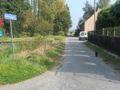
This hike of about 16 km mainly leads along unpaved paths, next to ditches and ponds. Hazewinkel, Zenne, the Leuvense Vaart, and the Dijle are part of the Zennegat. All ditches and ponds here were created by the meandering of the watercourses. Along the nature reserves Den Battelaer and Thiebroekbos. A beautiful walk in the flatlands of Rivierenland.
See something wrong on this route?Add an issue
Navigate route in...
 RouteYou app Open
Don't want to see this ad anymore?
→ Upgrade now

Please wait, the navigation is being prepared.
You can now navigate. Have fun on the road!
Processing your request has failed. Please try again.
Don't want to see this ad anymore?
→ Upgrade now
Please wait, your download is being prepared.
Your download is ready. Have fun on the road!
Processing your request has failed. Please try again.
Don't want to see this ad anymore?
→ Upgrade now
Please wait, your print is being prepared.
Your print is ready to download. Have fun on the road!
Processing your request has failed. Please try again.
Additional feedback:
This feature is only available to RouteYou PREMIUM subscribers.
Try 1 month for free and discover the difference! We don't take any payment details, and your trial ends automatically after one month.
© 2006-2026 RouteYou - www.routeyou.com



 173253






 Start
Start Download
 Download

