Lien copié. Collez le lien dans Instagram pour partager l'itinéraire.

 Azure
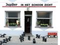
This 20 miles (32.18km) is a loop perfectly suited for the recreational cyclist as well as for the long endurance runner. You can start them from any other place as long as you take into account that the gpx starts at the church in Weerde (at café Schoonzicht).
This loop runs for more than 90% along low-traffic / -free roads: you hardly suffer from car traffic, unique for a crossing through the city of Vilvoorde and the busy Grimbergen.
A huge number of interesting locations are discussed along these traffic-free roads.
In order we give some of them: De Weerdemolen/toll tower; the Rubens Castle; the St. Anthony's Church in Houtem; the rehabilitated industrial area of the Marly coking plant and the imposing Parmentier hangar for wood drying - out of use - on the wood quay; a Sennemeander that leans dangerously close to the Sea Canal and where you cross via a metal bridge; to the left of this metal bridge you can see the Senne from the roof (70s when the Senne was an open smelly sewer) above ground behind the KITO-Parking -now TechnOV-; special sayings to the old school / swimming pool as well as beautifully renovated facades near the sports hall; fantastic graffiti under the bridge over the sea canal; the Three Fountains park with its hollow roads and open spaces; the cycling/running track behind the VTM complex; the Poststraat as a special hollow road; the Tangebeek forest; the slow road over the Kraaienberg with a unique panorama of Brussels; the Prinsenbos with the MOT (Museum for Older Techniques in the Guldendal) and the Prinsenkasteel; the abbey church and village centre with its slow roads; the Tommenmolen; the particularly long and beautiful Church Footpath to the Burnt Bridge; the beautiful bridge on the Keerdok -Cokereiestraat-; the overflow from the turning dock to the connection with the Zenne -Havendoklaan-; Dorent nature reserve along the Senne; the Stationsplein between the three railway lines through Weerde; and the Weerdse visput.
You have covered 10 km at the Vilvoorde bridge, 20 km at the Poddegemhoeve after the Tommenmolen; 30km to weerde station.
Playgrounds can be found in Houtem, at the Sporthal Vilvoorde; the domain Drie Fonteinen and the Prinsenbos. At various places you can also order a drink / snack, away from the crowds.
Some points of attention:
1. Departing from Weerde you cross the Senne from its left to right bank at the Werdemolen. Stay on this right side until you reach the remediated industrial area of the coking plant via the Bailey bridge to the left bank. This is only for a short time because on the spiral staircase at the Vilvoorde bridge you have unknowingly crossed the covered Senne again. See POI https://www.routeyou.com/location/view/47528242/van-de-radiatorenstraat-tot-de-vlaanderenstraat-over-de-verwijderde-cokesfabriek-bailey-zennebrug-en-houtkaai-of-langs-de-slachthuisstraat.nl
2.If you want to cross the Senne via the rehabilitated industrial area (Red path on the POI), you have to go through an opening to the left of a closed metal gate. There you have to lift your bike. Follow the demolition hills a few meters to your right with a fence behind them (not too short against it). When the demolition hills stop you will also see the fence turn west, go west there as well to the paved road. This red road shows you some special features at the Houtkaai (Senne crossing via old Bailey bridge, above ground coming from the Senne behind Vilvoorde, Parmentier drying hall for wood).
If you do not want to go through that terrain, follow the road further and take two right, after which you have a paved path at the end of the dead end road to the old Kanaalbrug (Blue path on the POI), where you can continue along the canal to the spiral staircase at the Vilvoorde bridge. This blue road gives you the opportunity to view several beautifully decorated old sayings on the façade of the old swimming pool / school, as well as some beautifully renovated facades along the sports hall.
3. Attention for the cyclists at the Vilvoorde bridge: you drive 200m on the left side of the road, take the footpath at adjacent bicycle traffic.
4. In the Three Fountains domain, you cross along the west side just under the Ring viaduct (to follow it on the Brussels side upwards - north direction. Before you get on that paved path, you have to descend about five meters just below the Ring towards Zeekanaal (the path you follow stops at that place). There you have a paved path that dead ends on the side of Vilvoorde, but splits on the Brussels side to the Zeekanaal and follows the Ring viaduct north. Follow the latter until it plunges back under the Ring viaduct, after which you continue to follow the winding forest path in a northerly direction in the Domain Three Fountains.
Beautiful green loop, you will notice.
Vous avez remarqué quelque chose sur cet itinéraire ?Ajouter rapport
Parcourir l'itinéraire dans...
 Application RouteYou Ouvrez
Vous ne voulez plus voir cette publicité ?
→ Actualiser maintenant

Veuillez patienter, la navigation est en cours de préparation.
Vous pouvez maintenant naviguer. Bonne route !
Le traitement de la demande a échoué. Veuillez réessayer.
Vous ne voulez plus voir cette publicité ?
→ Actualiser maintenant
Veuillez patienter, votre téléchargement est en cours de préparation.
Votre téléchargement est prêt. Bonne route !
Le traitement de la demande a échoué. Veuillez réessayer.
Vous ne voulez plus voir cette publicité ?
→ Actualiser maintenant
Veuillez patienter, votre impression est en cours de préparation.
Votre impression est prête à être téléchargée. Bonne route !
Le traitement de la demande a échoué. Veuillez réessayer.
Commentaires supplémentaires :
Cette fonctionnalité est exclusivement disponible pour les abonnés RouteYou PREMIUM.
Essayez 1 mois gratuit maintenant et découvrez la différence ! Nous n'exigeons aucune donnée de paiement et le service s'arrête automatiquement après votre période d'essai d'un mois.
© 2006-2026 RouteYou - www.routeyou.com


 wy




 Démarrer
 Télécharger
 Télécharger


