From: Bunt 33, 9220 Hamme, Flanders, Belgium
To: Bunt 33, 9220 Hamme, Flanders, Belgium
Routing: Walk - approximately 5 km
Starting point: Bunt parking at Wuitensnest/den Otter.
We start at the top of the Ringdijk. There we are greeted with an open and spacious view of the floodplain De Bunt. The construction works at the sluices of the floodplain are not accessible, which does not prevent us from fully explaining their importance in the planned measures as a defense against the threats of climate change. Via the ringdijk, we reach the path along the Durme and follow it to the Mirabrug - the Koolputten - along the left bank of the Durme, we follow the path until we reach the bridge of the N41, where we ascend on the left side the stairs that takes us to the top of the N41 bridge. From there, we have an overview of the Kleinbroek (east side) and the Grootbroek (west side). Crossing the bridge, we descend to the east side to the walking path and walk southward towards Biezestraat. We cross over and turn left behind the houses, following the path until we cross Biezestraat again to follow the walking path in Noubroek (De Bunt) until we return to the parking lot of departure.
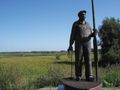
Walk De Bunt with the climate guide,
The Sigma projects are in full execution along the Durme and Scheldevallei. The climate guide will indicate the structural changes that these projects bring. Themes such as flooding risks, river pollution, soil contamination, dramatic decline in biodiversity, and many other aspects are to be addressed so that we can understand the connections. So that we become more aware that everything is interconnected. That the sea also starts in our street in every drainage pit...
See something wrong on this route?Add an issue
Navigate route in...
![]() RouteYou app Open
RouteYou app Open
Don't want to see this ad anymore?
→ Upgrade now
![]()
Please wait, the navigation is being prepared.
You can now navigate. Have fun on the road!
Processing your request has failed. Please try again.
Don't want to see this ad anymore?
→ Upgrade now
![]()
Please wait, your download is being prepared.
Your download is ready. Have fun on the road!
Processing your request has failed. Please try again.
Don't want to see this ad anymore?
→ Upgrade now
![]()
Please wait, your print is being prepared.
Your print is ready to download. Have fun on the road!
Processing your request has failed. Please try again.
<iframe src="https://plugin.routeyou.com/routeviewer/free/?language=en&params.route.id=8000947" width="100%" height="600" frameborder="0" allowfullscreen></iframe>
<p><a class="routeYou_embed" href="https://app.routeyou.com/en-be/route/view/8000947?utm_source=embed&utm_medium=article&utm_campaign=routeshare&navigation=external" title="Hamme De Bunt: out and about with the climate guide (derived) - RouteYou" target="_blank"><img src="https://image.routeyou.com/embed/route/960x670/8000947-en@2x.png" style="width: 100%; height: auto;" alt="Hamme De Bunt: out and about with the climate guide (derived)"></a></p>
Additional feedback:
This feature is only available to RouteYou PREMIUM subscribers.
Try 1 month for free and discover the difference! We don't take any payment details, and your trial ends automatically after one month.
© 2006-2026 RouteYou - www.routeyou.com