A WALK FROM NIEUWKERKE TO BAILLEUL AND BACK 22.6 KM
NODE POINTS: START MARKET NIEUWKERKE 34-35-38-37-36-53-52-51-50-43-44-45-47-32-33-35-36-42-41-38-31-30-19-18-20-21-22-55-54-25-24-26-28-29-32-33-31-34-ARRIVAL
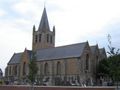
Address of starting point Market 8950 Heuvelland, Belgium
NIEUWKERKE
On the hill of present-day Nieuwkerke, an early settlement was established, located along the Roman road that ran over Terenburg, Kassel, Belle, Mesen and further over Wervik. Due to the Vikings making the coastal area unsafe in the 9th century, most coastal inhabitants fled to this wooded region. Nieuwkerke in the first half of the 17th century (image from Flandria Illustrata - 1641)
This resulted in a significant increase in the population around the end of the 9th and throughout the 10th century.
Nieuwkerke is located in Sandy Flanders and in the West Flanders Hill Country at an elevation of about 65 meters. Here lies the southern ridge of the hilly region with De Walletjes and Black Mill (80 meters). North of Nieuwkerke, the Douvebeek flows eastward. Towards the south, the height decreases rapidly to about 20 meters at the Belgian-French border. Here the valley of the Leie is approached. Info @wikipedia
Bailleul or Belle
Belle (French-Flemish: Belle and French: Bailleul) is a municipality in the north of France (Nord department), located in the French Westhoek and in French Flanders, which used to be part of the County of Flanders. The city has about 14,000 inhabitants and is part of the arrondissement of Dunkirk.
The lord of Belle allowed the inhabitants to build a belfry in 1177. A charter followed in 1249 (regulation in legal, tax, and economic terms). The economic boom was, as in many cities in Flanders, caused by the production of cloth from English wool. It was recognized by its color (red) and its mark: a sun or a lily. This prosperity ensured that Belle became the capital of a cassel.
In 1213, just before the Battle of Bouvines, the future king Louis VIII of France was sent by his father, king Philip II, to Flanders to plunder, among other places, Belle. He intended to prevent the Flemings from allying with England and the Holy Roman Empire against him.
In 1297, six years before the Golden Spurs Battle, king Philip the Fair conquered Belle. In 1436, it was the English again who set the city on fire after the failure of the Flemish Siege of Calais. The French returned again when Louis IX on March 19 1478 thought that the Flemings needed to be punished again because they chose a Habsburg, Emperor Maximilian I, as the bride for Mary of Burgundy, the daughter of Charles the Bold.
An accident caused the belfry and hundreds of houses to be destroyed again by a fire in 1503. At the end of the 16th century, the Spaniards were the destroyers of Belle, forcing the inhabitants to hide in Armentières for two years. As a result of all these calamities, the cloth producers sought other places. Together with numerous Calvinists among the population, they moved north and found a safe place to live in Holland and Zeeland. During the Eighty Years' War, the entire Westhoek depopulated greatly, and it took a long time for the economy to recover. For Belle, the city was also burned down twice. By the French on August 8, 1681, and by a brewery fire, the Belle fire Info @wikipedia
See something wrong on this route?Add an issue
Navigate route in...
![]() RouteYou app Open
RouteYou app Open
Don't want to see this ad anymore?
→ Upgrade now
![]()
Please wait, the navigation is being prepared.
You can now navigate. Have fun on the road!
Processing your request has failed. Please try again.
Don't want to see this ad anymore?
→ Upgrade now
![]()
Please wait, your download is being prepared.
Your download is ready. Have fun on the road!
Processing your request has failed. Please try again.
Don't want to see this ad anymore?
→ Upgrade now
![]()
Please wait, your print is being prepared.
Your print is ready to download. Have fun on the road!
Processing your request has failed. Please try again.
<iframe src="https://plugin.routeyou.com/routeviewer/free/?language=en&params.route.id=8574693" width="100%" height="600" frameborder="0" allowfullscreen></iframe>
<p><a class="routeYou_embed" href="https://app.routeyou.com/en-be/route/view/8574693?utm_source=embed&utm_medium=article&utm_campaign=routeshare&navigation=external" title="NIEUWKERKE-BAILLEUL 22.6 KM - RouteYou" target="_blank"><img src="https://image.routeyou.com/embed/route/960x670/8574693-en@2x.png" style="width: 100%; height: auto;" alt="NIEUWKERKE-BAILLEUL 22.6 KM"></a></p>
Additional feedback:
This feature is only available to RouteYou PREMIUM subscribers.
Try 1 month for free and discover the difference! We don't take any payment details, and your trial ends automatically after one month.
© 2006-2026 RouteYou - www.routeyou.com