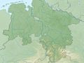
Around the Elbe-Weser watershed
Eichsfeld threshold, gypsum, dolomite, collapse pools, and the diverse South Harz landscape
This tour connects the separately signposted northern and southern branches of the Karst Trail. Along the way, you can stop in Steina for a meal or have coffee and cake at the Hofcafé in Bartolfelde (Fri-Sun, 2-5 pm). The tour is attractive in both directions. Here it is described counterclockwise from Nüxei.
The flat karst basin at Nussteich, a polje, collects water from the Fitzmühlen spring and backs up to the road during floods, at the same time the Steina flows into the basin. The waters disappear and part of them re-emerge at Salzaspring near Nordhausen. The path then passes the ford through the dry bed of the Steina, which lies dry eleven months of the year.
On the other side of the ford is the memorial site for the former Nüxei subcamp of the concentration camp, from where the Helmetal railway was built in 1944/45. As you climb towards Römerstein, you will see the Springwiese with various karst springs at the bottom right.
Römerstein (be careful when climbing!) is a 257 million-year-old coral reef made of dolomite rock. Just slightly older is Staufenbüttel, located south of Steina, a volcano from the early Permian period, 290 million years old. It also contains remnants of a dolomite reef.
A visit to the glass museum in Steina is worthwhile, showcasing the historical production of forest glass in the South Harz region. After a possible break, the path steeply ascends to Mühlberg with the watershed and a wide panorama of the South Harz landscape.
Another reef from the Zechstein period is the Eulenstein lying in the forest along the path. From here, you descend into Winkeltal, where the Talbach disappears into the karst at the upper end of the meadow. There was once a modest mining activity here for copper and iron.
At the valley exit, the high bridge of the B243n surprises. The Moostierchenriff is an abandoned quarry near Bartolfelde. As a natural monument, it is described in countless scientific works. It shows a snapshot of the Zechstein sea from the northwest against a graywacke cliff of the old Harz mountains.
In Bartolfelde, you can stop at the Hofcafé on weekends: our tip: firefighter cake.
Then continue on the southern branch of the Karst Trail over collapse pools formed in the younger gypsum of the Zechstein through gypsum dissolution, such as the water-filled Grundlos. Beautiful panoramas of the southern Harz also open up from here. The path now crosses the route of the unfinished Helmetal railway.
Continue over the heap of the dolomite quarry at Wolfskuhle, from whose deposit the building stones for the Walkenried Abbey were extracted 800 years ago. They are fine dolomitic deposits in a former tropical lagoon.
The path crosses the blind valley of Steingraben, which disappears slightly above in the bushes in a karst swallow hole and reappears at Salzaspring near Nordhausen. Across meadows and horse pastures, return to the starting point in Nüxei.
At the B 243 near Nüxei
See something wrong on this route?Add an issue
Navigate route in...
![]() RouteYou app Open
RouteYou app Open
Don't want to see this ad anymore?
→ Upgrade now
![]()
Please wait, the navigation is being prepared.
You can now navigate. Have fun on the road!
Processing your request has failed. Please try again.
Don't want to see this ad anymore?
→ Upgrade now
![]()
Please wait, your download is being prepared.
Your download is ready. Have fun on the road!
Processing your request has failed. Please try again.
Don't want to see this ad anymore?
→ Upgrade now
![]()
Please wait, your print is being prepared.
Your print is ready to download. Have fun on the road!
Processing your request has failed. Please try again.
<iframe src="https://plugin.routeyou.com/routeviewer/free/?language=en&params.route.id=14057361" width="100%" height="600" frameborder="0" allowfullscreen></iframe>
<p><a class="routeYou_embed" href="https://app.routeyou.com/en-de/route/view/14057361?utm_source=embed&utm_medium=article&utm_campaign=routeshare&navigation=external" title="Around the watershed Elbe-Weser - Karstwanderweg circular trail No. 16 - RouteYou" target="_blank"><img src="https://image.routeyou.com/embed/route/960x670/14057361-en@2x.png" style="width: 100%; height: auto;" alt="Around the watershed Elbe-Weser - Karstwanderweg circular trail No. 16"></a></p>
Additional feedback:
This feature is only available to RouteYou PREMIUM subscribers.
Try 1 month for free and discover the difference! We don't take any payment details, and your trial ends automatically after one month.
© 2006-2026 RouteYou - www.routeyou.com