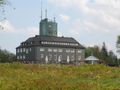
250 km of hiking bliss and magnificent views from Meinerzhagen and Altena to Korbach. Panorama, mountain peaks and towers. Enjoy the silence & forget everyday life. Discover nature. Sporty or leisurely. Experience the Sauerland from above.
Marking and signposting
Well-marked paths and a clearly signposted network of trails help with orientation:
On the Sauerland-Höhenflug, there are hiking signs at all junctions where several hiking trails meet. These provide information about a local and long-distance destination on the Höhenflug with the respective distance in kilometers. They also provide information about the exact location with UTM coordinates, the altitude of the location and the hiking trails to the left and right.
The Sauerland-Höhenflug is also marked at regular intervals for safe hiking. These markings are constantly checked by the rangers of the Landesbetrieb Wald und Holz NRW and by the Sauerland Mountain Association and tightened if necessary. Safe hiking markings and signs are an important criterion for certification as a Wanderbares Deutschland quality trail.
The most important markings on the Sauerland-Höhenflug are:
The white H on a yellow background marks the Sauerland-Höhenflug main trail The white H on a blue background marks a Sauerland-Höhenflug circular trail The white H on a black background marks the Sauerland-Höhenflug access trailIn an emergency, things have to move quickly! That's why the Sauerland-Höhenflug is equipped with so-called rescue signs throughout. The green and white plaques attached to the posts of the signposts have a number that you must give when making an emergency call. This means that the emergency services know exactly where you are and valuable time can be saved.
See something wrong on this route?Add an issue
Navigate route in...
![]() RouteYou app Open
RouteYou app Open
Don't want to see this ad anymore?
→ Upgrade now
![]()
Please wait, the navigation is being prepared.
You can now navigate. Have fun on the road!
Processing your request has failed. Please try again.
Don't want to see this ad anymore?
→ Upgrade now
![]()
Please wait, your download is being prepared.
Your download is ready. Have fun on the road!
Processing your request has failed. Please try again.
Don't want to see this ad anymore?
→ Upgrade now
![]()
Please wait, your print is being prepared.
Your print is ready to download. Have fun on the road!
Processing your request has failed. Please try again.
<iframe src="https://plugin.routeyou.com/routeviewer/free/?language=en&params.route.id=14059853" width="100%" height="600" frameborder="0" allowfullscreen></iframe>
<p><a class="routeYou_embed" href="https://app.routeyou.com/en-de/route/view/14059853?utm_source=embed&utm_medium=article&utm_campaign=routeshare&navigation=external" title="Sauerland-Höhenflug - RouteYou" target="_blank"><img src="https://image.routeyou.com/embed/route/960x670/14059853-en@2x.png" style="width: 100%; height: auto;" alt="Sauerland-Höhenflug"></a></p>
Additional feedback:
This feature is only available to RouteYou PREMIUM subscribers.
Try 1 month for free and discover the difference! We don't take any payment details, and your trial ends automatically after one month.
© 2006-2026 RouteYou - www.routeyou.com