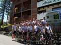
We rode this loop on our second day. The nice thing about this climb is that it can be approached from 5 different sides. So we have the choice of whether to focus on weight or the length of the climb on this loop. If we choose the challenging option, we get beautiful descents of 30 km. We did not opt for the easiest route; the first climb is great but very difficult. The start is directly in the range of 10 to 12%. Later it gets a bit better and we even have 2 km of a gentle descent. Then the last stretch to the summit of Erbe. As we pass through the small village, the toughest section awaits us. After that, just a few km to the summit. The descent is extremely spectacular. Riding down with 15 cyclists on very narrow paths is an adrenaline rush. The descent is surely 32 km long and 10 km before the end we take a break in a small restaurant to eat some spaghetti. Afterwards, we ride the last 10 km down to Burnico. Then a few more km along the river and back up to Erbe. Now comes the climb of 30 km. An average of 10 km, taking just under 3 hours to climb. Arriving at the top is a great feeling that we made it. Now just the descent and the gentle slope to Predaces. That was a fantastic ride, tough but very rewarding.
See something wrong on this route?Add an issue
Navigate route in...
![]() RouteYou app Open
RouteYou app Open
Don't want to see this ad anymore?
→ Upgrade now
![]()
Please wait, the navigation is being prepared.
You can now navigate. Have fun on the road!
Processing your request has failed. Please try again.
Don't want to see this ad anymore?
→ Upgrade now
![]()
Please wait, your download is being prepared.
Your download is ready. Have fun on the road!
Processing your request has failed. Please try again.
Don't want to see this ad anymore?
→ Upgrade now
![]()
Please wait, your print is being prepared.
Your print is ready to download. Have fun on the road!
Processing your request has failed. Please try again.
<iframe src="https://plugin.routeyou.com/routeviewer/free/?language=en&params.route.id=167988" width="100%" height="600" frameborder="0" allowfullscreen></iframe>
<p><a class="routeYou_embed" href="https://app.routeyou.com/en-it/route/view/167988?utm_source=embed&utm_medium=article&utm_campaign=routeshare&navigation=external" title="2010-2 Passo delle Erbe 110 km, ±3241 m. - RouteYou" target="_blank"><img src="https://image.routeyou.com/embed/route/960x670/167988-en@2x.png" style="width: 100%; height: auto;" alt="2010-2 Passo delle Erbe 110 km, ±3241 m."></a></p>
Additional feedback:
This feature is only available to RouteYou PREMIUM subscribers.
Try 1 month for free and discover the difference! We don't take any payment details, and your trial ends automatically after one month.
© 2006-2026 RouteYou - www.routeyou.com