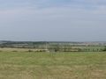
The local trails_south route in Luxembourg runs from Mess to Circuit E and is 9 kilometers long. It is a hiking route that goes through the municipality of Reckingen/Mess. Reckingen is a municipality in the Grand Duchy of Luxembourg and belongs to the canton of Esch-sur-Alzette. The village of Reckingen has existed since the 10th century and the municipality in its current form since 1784. More information about Reckingen is available on Wikipedia.
See something wrong on this route?Add an issue
Navigate route in...
![]() RouteYou app Open
RouteYou app Open
Don't want to see this ad anymore?
→ Upgrade now
![]()
Please wait, the navigation is being prepared.
You can now navigate. Have fun on the road!
Processing your request has failed. Please try again.
Don't want to see this ad anymore?
→ Upgrade now
![]()
Please wait, your download is being prepared.
Your download is ready. Have fun on the road!
Processing your request has failed. Please try again.
Don't want to see this ad anymore?
→ Upgrade now
![]()
Please wait, your print is being prepared.
Your print is ready to download. Have fun on the road!
Processing your request has failed. Please try again.
<iframe src="https://plugin.routeyou.com/routeviewer/free/?language=en&params.route.id=10959740" width="100%" height="600" frameborder="0" allowfullscreen></iframe>
<p><a class="routeYou_embed" href="https://app.routeyou.com/en-lu/route/view/10959740?utm_source=embed&utm_medium=article&utm_campaign=routeshare&navigation=external" title="Local Trails_South: Measurement - Circuit E - RouteYou" target="_blank"><img src="https://image.routeyou.com/embed/route/960x670/10959740-en@2x.png" style="width: 100%; height: auto;" alt="Local Trails_South: Measurement - Circuit E"></a></p>
Additional feedback:
This feature is only available to RouteYou PREMIUM subscribers.
Try 1 month for free and discover the difference! We don't take any payment details, and your trial ends automatically after one month.
© 2006-2026 RouteYou - www.routeyou.com