Thanks to our partner haroldslegers you get free access to this route – and make your acquaintance with RouteYou PLUS.
Discover all benefitsMany Dutch people who travel south to cycle in South Limburg go to Valkenburg or even further into South Limburg. However, you can also start directly from Geleen and connect many climbs in the northern part of South Limburg.
The route is traveled counterclockwise and starts in Genhout, near Spaubeek. It is easily accessible via the A76 (exit Spaubeek). However, there is no westbound exit for Spaubeek on the way back. You will need to go to Neerbeek to take the ramp to the A76 there.
The first 9 km from Groot Genhout are ridden warm-up. You first ride to Elsloo to descend via the cobblestones to the Maastal. Near Geulle, you first encounter the Slingerberg, then you descend the Snijdersberg and climb up the Schieversberg.
Then you head towards Meerssen and follow the climb of the Visweg. After the descent into the Geuldal, you follow the Geul for a few kilometers along a road closed to motor traffic. You leave the Geuldal via the climb of the steep Brakkenberg (up to 14%).
After that, you head towards Bemelen (you descend the Bemelerberg) and then climb the path/cycle path to Groeve 't Rooth. Then you head towards Valkenburg (by descending through the Sibbergrubbe). The always busy Valkenburg is exited via the climb of the Goudsberg. Then, on rural roads, you follow the climbs of Holleweg Schin op Geul, Schaapsdries, Vrouwendelweg (which gets steeper towards the end), Trintelerberg-South, Colmont, and Hooggats.
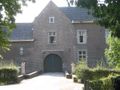
After that, there are a few smaller climbs on very rural roads like those from Craubeek, Vink, and Nelisweg. You pass through the beautiful village of Terstraten. You also pass Wijnandsrade Castle.
Near Schinnen, you take some small climbs over the slopes on the north side of the Geleenbeek valley, climbing the Wolfhagen and the steep Stammenderbos (Stammenhof). You also pass Terborgh Castle. You descend the Sweikhuizerberg, go a short distance through Geleen towards Neerbeek. Finally, you go to Spaubeek, and then the last climb, known as Hobbelrade, follows.
Note: You will cross hollow ways multiple times, including on the plateau of Margraten (between the hamlet of 't Rooth and the village of Groot-Welsden). After a rainy period, sand can accumulate on the hollow ways, washed out from the surrounding fields.
See something wrong on this route?Add an issue
Navigate route in...
![]() RouteYou app Open
RouteYou app Open
![]()
Please wait, your print is being prepared.
Your print is ready to download. Have fun on the road!
Processing your request has failed. Please try again.
<iframe src="https://plugin.routeyou.com/routeviewer/free/?language=en&params.route.id=4518534" width="100%" height="600" frameborder="0" allowfullscreen></iframe>
<p><a class="routeYou_embed" href="https://app.routeyou.com/en-nl/route/view/4518534?utm_source=embed&utm_medium=article&utm_campaign=routeshare&navigation=external" title="Variant South Limburg nearby - RouteYou" target="_blank"><img src="https://image.routeyou.com/embed/route/960x670/4518534-en@2x.png" style="width: 100%; height: auto;" alt="Variant South Limburg nearby"></a></p>
Additional feedback:
This feature is only available to RouteYou PREMIUM subscribers.
Try 1 month for free and discover the difference! We don't take any payment details, and your trial ends automatically after one month.
© 2006-2026 RouteYou - www.routeyou.com