41 views | Public
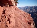
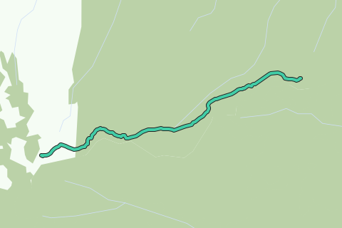
The Nankoweap Trail is an unmaintained hiking trail on the North Rim of the Grand Canyon National Park, located in the U.S. state of Arizona. The Nankoweap trail descends 6,040 feet in 14 miles from the Saddle Mountain trailhead to Nankoweap Creek and on to the Colorado River. It is considered to be the hardest of the trails into the Canyon. Hikers have to carry and cache water as there is none in the 11 miles between the trailhead and Nankoweap Creek.
Inspired by OSM.
See something wrong on this route?Add an issue
Navigate route in...
![]() RouteYou app Open
RouteYou app Open
Don't want to see this ad anymore?
→ Upgrade now
![]()
Please wait, the navigation is being prepared.
You can now navigate. Have fun on the road!
Processing your request has failed. Please try again.
Don't want to see this ad anymore?
→ Upgrade now
![]()
Please wait, your download is being prepared.
Your download is ready. Have fun on the road!
Processing your request has failed. Please try again.
Don't want to see this ad anymore?
→ Upgrade now
![]()
Please wait, your print is being prepared.
Your print is ready to download. Have fun on the road!
Processing your request has failed. Please try again.
<iframe src="https://plugin.routeyou.com/routeviewer/free/?language=en&params.route.id=2056825" width="100%" height="600" frameborder="0" allowfullscreen></iframe>
<p><a class="routeYou_embed" href="https://app.routeyou.com/en-us/route/view/2056825?utm_source=embed&utm_medium=article&utm_campaign=routeshare&navigation=external" title="Nankoweap Trail - RouteYou" target="_blank"><img src="https://image.routeyou.com/embed/route/960x670/2056825-en@2x.png" style="width: 100%; height: auto;" alt="Nankoweap Trail"></a></p>
Additional feedback:
This feature is only available to RouteYou PREMIUM subscribers.
Try 1 month for free and discover the difference! We don't take any payment details, and your trial ends automatically after one month.
© 2006-2025 RouteYou - www.routeyou.com